

The Challenge of Isolation
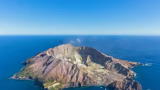
Many of the world's 1,500 potentially active volcanoes are located in isolated areas, from the Aleutian chain in Alaska to the South Sandwich Islands in the Atlantic. These remote locations make traditional, ground-based monitoring incredibly difficult,
dangerous, and expensive. Scientists can't simply install and maintain a network of sensors as they might at more accessible volcanoes like Mount St. Helens. This leaves vast, volcanically active regions of the planet largely unobserved, posing a hidden risk to air traffic, shipping lanes, and distant communities that could be affected by ash clouds or tsunamis.
An Eye in the Sky
Space technology offers a powerful solution. Orbiting satellites provide a global, consistent, and safe way to keep watch. Different satellites carry different instruments, each providing a unique piece of the puzzle. This diverse toolkit allows volcanologists to look for key signs of unrest without ever setting foot on the volcano itself. They can measure subtle changes in the ground shape, detect rising heat, and even analyze the gases seeping from a volcano's cone. This ability to monitor from afar has revolutionized volcanology, turning many unmonitored peaks into observable hazards.
Measuring the Ground's Swelling
One of the most critical indicators of a potential eruption is ground deformation. As magma moves and accumulates in chambers beneath a volcano, it causes the ground surface to swell, tilt, and shift. Two key space-based technologies track this. Interferometric Synthetic Aperture Radar (InSAR) uses radar signals from satellites to create detailed maps of the ground. By comparing images taken at different times, scientists can detect centimetre-scale changes in elevation, revealing if a volcano is 'inflating' like a balloon with rising magma. This is especially useful for remote volcanoes where on-the-ground instruments aren't feasible.
Precise Positioning with GPS
Working in tandem with InSAR is the Global Positioning System (GPS). While InSAR provides a broad picture of deformation, highly sensitive GPS receivers placed on a volcano (when access is possible) can measure three-dimensional movement with millimetre-scale precision. Continuous GPS stations transmit data in real-time, allowing scientists to track sudden and rapid changes that might signal magma moving towards the surface just hours or days before an eruption. This combination of a wide-area view from InSAR and precise point data from GPS gives a more complete picture of what is happening underground.
Taking a Volcano's Temperature
Another vital sign is heat. As magma rises, it heats the ground and releases warm gases. Satellites equipped with thermal infrared sensors, like ASTER and MODIS on NASA's Terra satellite, can detect these temperature anomalies from space. They can spot hotspots that may indicate magma is near the surface, even before an eruption begins. By comparing images over time, researchers can identify new or intensifying thermal areas, another crucial clue that a volcano is waking up. These satellites can also track the spread of dangerous ash clouds after an eruption has started, which is critical for aviation safety.