


A Fire That Creates a Storm
During a period of intense wildfires that swept through southwestern France, firefighters and observers witnessed something astonishing. Towering above the smoke and flames, a massive, menacing cloud began to form, looking like a full-blown thunderstorm.
This wasn't a separate weather system moving in; it was being generated by the fire itself. The event in the Gironde region, which forced the evacuation of tens of thousands of people, was marked by the formation of a pyrocumulonimbus cloud, a phenomenon so rare in the region it was reportedly the first ever officially documented in France. It was a stark confirmation that the blaze had become so powerful it was now influencing the atmosphere on a massive scale.
What is a Pyrocumulonimbus?
The name sounds complex, but it's a literal description. 'Pyro' is Greek for fire, 'cumulus' refers to the heap-like shape of the cloud, and 'nimbus' signifies it's a rain-bearing storm cloud. Essentially, a pyrocumulonimbus—or pyroCb for short—is a thunderstorm spawned by a source of intense heat on the ground, most commonly a massive wildfire. NASA has aptly nicknamed it the “fire-breathing dragon of clouds.” Unlike a normal thunderstorm that draws its energy from warm, moist air near the surface, a pyroCb is fuelled directly by the colossal energy of a fire. The process turns a disaster on the ground into a terrifying atmospheric event.
The Science of a Fire Cloud
The formation begins with the fire itself. A huge, hot wildfire acts like a giant chimney, creating a powerful updraft that sucks in smoke, ash, and water vapour from the burning vegetation and surrounding air. This column of superheated air rises rapidly, sometimes miles into the atmosphere. As it ascends into colder, lower-pressure layers of the sky, it cools and expands. The water vapour, with plenty of ash particles to cling to, condenses and forms a cloud. If the fire is intense enough, this updraft continues to punch upwards, pushing the cloud to altitudes of 10 to 15 kilometres—as high as commercial jets fly. At these heights, the moisture freezes, releasing more energy and fuelling the cloud's transformation into a true thunderstorm.
A Dangerous and Unpredictable Cycle
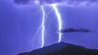
A pyrocumulonimbus isn't just a dramatic spectacle; it's incredibly dangerous because it creates a feedback loop. The storm cloud can generate its own lightning, which can strike miles away from the initial blaze, igniting new fires and making the situation even harder to control. This is exactly what happened in Gironde. Furthermore, these fire storms produce powerful, erratic winds and violent downdrafts that can change the fire's direction in an instant, spreading flames unpredictably and endangering firefighting crews on the ground. The cloud itself becomes a self-sustaining weather engine, making a dangerous fire even more chaotic and destructive.
A Sign of a Changing Planet
While the Gironde event was a shock for France, these fire clouds are not entirely new. They have been documented during catastrophic wildfire seasons in Australia and North America. However, their appearance in Europe is a worrying sign. Scientists agree that climate change is creating conditions—hotter temperatures, prolonged droughts, and drier vegetation—that lead to more frequent and intense wildfires. These are precisely the ingredients needed to cook up a pyrocumulonimbus storm. As extreme fire events become more common across the globe, including in fire-prone regions of India, understanding these fire-generated weather systems is crucial for predicting fire behaviour and protecting communities from their devastating power.