








A New Orbit, A New Perspective
Most Earth observation satellites, like those in the Cartosat or RISAT series, operate in a Low Earth Orbit (LEO), circling the globe hundreds of kilometres up. They capture high-resolution images but can only view a specific location for a few minutes
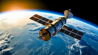
before moving on, returning to the same spot only after a set interval. EOS-05 is different. It is India’s first imaging satellite designed to operate from a geosynchronous orbit (GEO), approximately 36,000 kilometres away. At this altitude, the satellite’s speed matches the Earth’s rotation, allowing it to seemingly ‘hover’ over the Indian subcontinent. This eliminates the frustrating wait times of LEO satellites and provides a persistent, uninterrupted view of a massive geographical area.
What Is EOS-05?
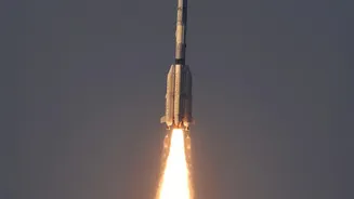
EOS-05 is a state-of-the-art geo-imaging satellite developed by the Indian Space Research Organisation (ISRO). The mission is a successor to the GISAT-1 program, representing India’s successful effort to place a powerful, continuous-monitoring eye in a high-altitude orbit. Launched aboard the GSLV-F17 rocket, the 2,367 kg satellite is a significant technological achievement. Its primary objective is to provide near-real-time imaging of India and its surrounding regions, enabling rapid monitoring of weather patterns, natural disasters, and strategic areas. The successful launch on September 4, 2026, was a major milestone, especially after a previous attempt with a similar satellite ended in failure in 2021.
The Power of Constant Observation
What makes EOS-05 so powerful is its advanced imaging payload. The satellite is equipped with multispectral and hyperspectral sensors, including a high-resolution 700mm optical telescope. This allows it to not only see but also to analyze what it sees in incredible detail across various light spectrums. The key advantage is its rapid revisit capability. Under clear skies, EOS-05 can capture an image of a specific area of interest, such as a brewing cyclone or a forest fire, every five to ten minutes. Furthermore, it can complete a full scan of the entire Indian landmass in about 30 minutes. This transforms data collection from a periodic snapshot into a continuous, live feed.
A Game-Changer for Disaster Management
For a nation prone to natural disasters, this near-real-time capability is revolutionary. In the past, authorities had to wait for a satellite to pass over a flood-affected or cyclone-hit area to assess the damage. With EOS-05, disaster management agencies can track the development of cyclones in the Bay of Bengal, monitor the spread of forest fires, and observe flash floods as they happen. This continuous flow of information allows for quicker and more effective emergency response, better planning for evacuations, and more accurate damage assessment, ultimately helping to save lives and resources.
Strengthening National Security
Beyond its civilian uses, EOS-05 provides a significant boost to India's strategic capabilities. The ability to maintain an unblinking eye over the nation's land and maritime borders offers an unprecedented level of situational awareness. The satellite provides uninterrupted coverage of the Line of Actual Control (LAC) and the Line of Control (LoC), as well as key passages in the Indian Ocean. This gives security agencies a powerful tool for monitoring troop movements, detecting incursions, and keeping watch over strategic assets without the coverage gaps inherent in LEO satellites. It functions as a persistent sentry, enhancing national security infrastructure in a profound way.