





A Fire That Makes Its Own Weather
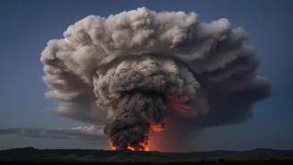
Firefighters in southwest France are battling more than just flames. A colossal wildfire, fed by hot, dry winds, has grown so intense that it has created a phenomenon straight out of a disaster movie: a pyrocumulonimbus cloud. This fire-generated thunderstorm
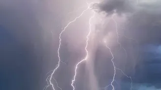
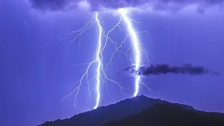
is now actively working against containment efforts, hurling lightning bolts that have ignited fresh blazes kilometres away from the main fire front. Officials confirmed the new ignitions, describing the situation as exceptionally dangerous and unpredictable. The main fire has already consumed thousands of hectares, but this new development has escalated the crisis, creating a multi-front battle against a fire that is now, in a sense, breeding its own spread.
What Is a Pyrocumulonimbus?
The term sounds technical, but the concept is alarmingly simple. Think of it as a thunderstorm born from a fire. NASA has even called it the "fire-breathing dragon of clouds". "Pyro" comes from the Greek word for fire, while "cumulonimbus" is the scientific name for a towering thundercloud. When a fire burns hot enough over a large enough area, it creates a powerful updraft of superheated air. This column of air carries smoke, ash, and water vapour high into the atmosphere. As this plume rises to colder altitudes, the water vapour condenses onto ash particles, forming a massive, smoky cloud that essentially becomes its own storm cell.
From Smoke Plume to Thunderstorm
The transformation from a simple smoke plume into a pyrocumulonimbus cloud is a dramatic escalation. The intense heat from the wildfire acts like a powerful engine, pushing air upwards at speeds that can exceed 100 kilometres per hour. This violent updraft draws in more air from the surrounding environment, feeding the fire with oxygen while also pulling more moisture into its developing cloud system. As the cloud mushrooms vertically, sometimes reaching heights of over 15 kilometres—well into the cruising altitude of commercial airliners—the processes inside begin to mimic a classic thunderstorm. The sheer vertical power of the updraft is what defines this phenomenon and makes it so hazardous.
The Danger of Fire-Generated Lightning
The most terrifying capability of a pyrocumulonimbus cloud is its ability to produce lightning. Inside the turbulent, towering cloud, water droplets, ice crystals, and ash particles collide violently. This friction strips electrons and creates a massive separation of electrical charge, with the top of the cloud becoming positively charged and the bottom negatively charged. When this electrical imbalance becomes too great, the cloud discharges it as a bolt of lightning. Unlike a regular thunderstorm that might bring cooling rain, a pyrocumulonimbus storm often brings "dry lightning." These strikes hit the ground, which is already tinder-dry from the same heatwave conditions feeding the main fire, and act as a new source of ignition far from the established fire line.
A Firefighter's Worst Nightmare
This behaviour makes an already difficult fire nearly impossible to fight. Firefighting strategies rely on predicting a fire's spread, but a pyrocumulonimbus event throws all predictions out the window. The downdrafts from the collapsing storm cell can create erratic, gale-force winds on the ground, changing the fire's direction in an instant. The lightning can spark new "spot fires" far behind containment lines, trapping crews and forcing them to abandon established positions. The smoke and ash can also be so thick that air support, such as water-bombing planes, becomes too dangerous to operate. It creates a vicious cycle: the fire gets stronger, which makes the cloud stronger, which in turn makes the fire spread in unpredictable new ways.
A Global Warning Sign
While pyrocumulonimbus events are not entirely new, scientists note they are becoming alarmingly more frequent and intense around the world, from Australia to North America and now France. In fact, French officials stated this was the first time such a phenomenon had been recorded in the country. This trend is directly linked to the increasing intensity of wildfires driven by climate change, which leads to hotter and drier conditions. For a country like India, with its vast forest cover and vulnerability to extreme weather, the events in France serve as a stark warning. As fire seasons become longer and more severe, the possibility of our own wildfires generating these destructive weather systems grows. Understanding and preparing for such complex disasters is a critical part of climate adaptation efforts globally.