


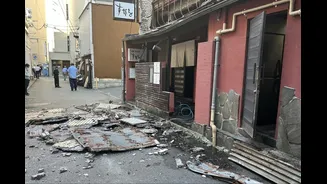
A Land on Four Plates
Japan's dramatic landscapes and volcanic hot springs are born from the same violent geology that puts its population at risk. The nation is situated at the junction of four massive tectonic plates: the Pacific, North American, Eurasian, and Philippine
Sea plates. These colossal slabs of the Earth's crust are in constant, slow-motion collision. The Pacific plate, for instance, slides under northern Japan at a rate of about 8 to 9 centimeters per year. This process of subduction, where one plate is forced beneath another, is not smooth. The plates lock, build up immense stress, and then suddenly release that energy, causing the ground to shake. This precarious position on the 'Pacific Ring of Fire' means that tremors are a part of life, and the potential for a major, destructive earthquake is a constant reality.
The Eyes and Ears of the Earth
To manage this ever-present risk, Japan has developed arguably the world's most advanced earthquake monitoring system. It's a vast, high-tech nervous system with 'eyes and ears' embedded throughout the land and seafloor. At the heart of this system are several overlapping networks of seismographs managed by the Japan Meteorological Agency (JMA) and the National Research Institute for Earth Science and Disaster Resilience (NIED). These networks, including K-NET, KiK-net, and the high-sensitivity Hi-net, comprise thousands of sensors. K-NET alone consists of over 1,000 stations spaced roughly 20 kilometers apart, designed to capture strong ground shaking. KiK-net pairs surface seismographs with instruments placed deep in boreholes, providing crucial data on how seismic waves are amplified by surface geology. This dense web of over 4,200 seismometers ensures no significant tremor goes unnoticed.
Seconds That Save Lives
Monitoring is one thing; warning is another. This is where the Earthquake Early Warning (EEW) system comes in. Launched for the public in 2007, the system is a marvel of physics and speed. Earthquakes generate different types of seismic waves. The first to arrive are the faster, less destructive primary waves (P-waves). They are followed by the slower, more damaging secondary waves (S-waves) that cause the violent shaking. The EEW system is designed to detect the initial P-waves, instantly calculate the earthquake's epicenter and magnitude, and broadcast a warning before the more destructive S-waves arrive. This can give people anywhere from a few seconds to over a minute of advance notice—enough time to drop, cover, and hold on; for surgeons to stop operating; or for bullet trains to apply emergency brakes. The warnings are pushed out simultaneously through mobile phones, television, radio, and public loudspeaker systems.
Beyond the Tremor
The monitoring network's job doesn't end with the shaking. For a country with over 12,000 kilometers of coastline, the risk of a tsunami following an offshore earthquake is severe. When a quake is detected at sea, the JMA uses data from its seismic networks and dedicated offshore tsunami buoys to estimate the potential for a tsunami. If a threat is identified, warnings are issued, often within just three minutes of the earthquake. The network also incorporates thousands of GPS stations that can detect minute shifts in the land, providing data on crustal deformation that helps in long-term forecasting. This integrated approach, combining land, sea, and satellite data, provides a comprehensive picture of the country's ever-changing geology.
A Never-Ending Task
Despite its sophistication, the system is in a state of constant evolution. Major seismic events, like the devastating 2011 Tōhoku earthquake and tsunami, serve as harsh but vital learning experiences. That event prompted significant upgrades to the warning systems, particularly in how they assess and communicate the scale of massive, complex quakes and the tsunamis they can generate. Researchers are now exploring how to better utilize seafloor observation networks like S-net and DONET, and even how to incorporate artificial intelligence to improve the speed and accuracy of warnings. The goal is not to predict earthquakes—a feat still beyond scientific capabilities—but to refine the warnings and give people the best possible chance to protect themselves when the ground inevitably begins to shake again.