






The Planet's 100-Year Forecast
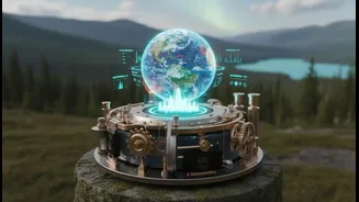
Imagine a weather forecast that tries to predict not just next week's rain, but the state of entire ecosystems—forests, rivers, and coastlines—a century from now. These are long-term ecological projections, sophisticated computer models that simulate
the future of our planet under different climate change scenarios. These models take into account rising temperatures, changing rainfall patterns, and human land use to predict fundamental shifts, such as which forests might turn into grasslands or which coastlines could be submerged. For a country like India, these projections are not abstract concepts. They forecast profound impacts on climate-sensitive sectors like agriculture and forestry, which millions of people depend on for their livelihoods. They warn of everything from decreased snow cover in the Himalayas, affecting the flow of major rivers like the Ganges, to threats against our unique biodiversity hotspots.
Why These Projections Matter
These century-long forecasts are a critical tool for national planning. Knowing how ecosystems are likely to change allows governments and industries to make smarter, more resilient decisions. If models project severe water stress in a particular region, for instance, it informs long-term water management and agricultural policies. If coastal areas are shown to be at high risk from sea-level rise, it can guide infrastructure development and conservation efforts for vital ecosystems like mangroves, which act as natural barriers. Projections for India suggest a future with more frequent and intense heatwaves, floods, and droughts, impacting food security and public health. The economic toll could be substantial, with potential losses in agriculture and damage to coastal infrastructure. Ignoring these projections would be like sailing into a storm without a map; they provide the essential foresight needed to prepare for the environmental challenges ahead and protect both communities and natural heritage.
The Challenge of Checking the Forecast
A forecast is useless if you can never tell whether it was accurate. This is the core challenge with century-long projections. Our traditional methods for monitoring ecosystems are often too slow, expensive, and limited in scope to effectively validate these complex models. Ecologists have historically relied on painstaking fieldwork—manually counting species, measuring trees, and taking water samples. While incredibly valuable, these methods can't easily scale to cover the vast and diverse landscapes of a nation like India. Current monitoring often has significant geographical and taxonomic biases, focusing on accessible areas and certain types of species while leaving huge data gaps elsewhere. This lack of comprehensive, real-time data makes it difficult to track changes as they happen and, crucially, to refine the models to make them more accurate over time.
A New Generation of Eyes on Earth
To bridge this gap, scientists are turning to a new suite of technologies that can monitor the planet with unprecedented detail and scale. This is the “better ecosystem monitoring” the future requires. One of the most revolutionary tools is environmental DNA, or eDNA. By analyzing traces of genetic material in water, soil, or even air, scientists can detect the presence of hundreds of species without ever seeing them. Drones equipped with LiDAR sensors can create intricate 3D maps of forest canopies, measuring their health and structure, while bioacoustic sensors listen for the sounds of birds and insects, providing a constant stream of data on biodiversity. These technologies, powered by artificial intelligence to process the enormous amounts of data, allow for a continuous, large-scale health check of our environment.
From Theory to Actionable Intelligence
Adopting these advanced monitoring techniques is about more than just better science; it's about turning theoretical projections into actionable intelligence. When a forecast predicts a decline in a specific fish population, autonomous eDNA samplers can be deployed to confirm changes in real time. When a model suggests a forest is under stress, drone-based thermal imagery can detect it before it’s visible to the human eye. This ground-truthing capability builds confidence in the models, providing policymakers with the concrete evidence needed to justify significant, long-term investments in climate adaptation and conservation. For India, integrating these technologies could revolutionize the management of its natural resources, from the Himalayan ecosystems to its extensive coastline, ensuring that conservation and development efforts are based on the most accurate and up-to-date understanding of our changing environment.