






Akvan's Path and Predicted Impact
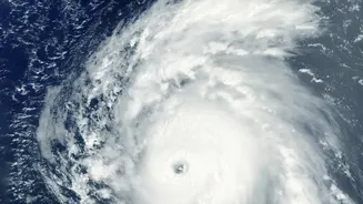
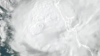
According to the India Meteorological Department (IMD), Severe Cyclonic Storm Akvan was located over the west-central Bay of Bengal as of November 18th and 19th. The system has been moving north-northwestwards and is forecast to cross the coast between
Narsapur in Andhra Pradesh and Puri in Odisha around noon on November 20th. At landfall, it is expected to be a severe cyclonic storm with sustained wind speeds of 90-100 kmph, gusting up to 110 kmph. The IMD has issued a 'Red Message' cyclone warning for the coasts of North Andhra Pradesh, Yanam, and South Odisha. Authorities in the affected states are on high alert, with disaster response teams, including the NDRF and SDRF, mobilised for emergency operations. Fishermen have been warned not to venture into the sea, and residents in low-lying coastal areas are being advised to move to safer locations.
The Story Behind the Name
Every cyclone in the North Indian Ocean gets a unique name to aid in communication and public awareness. The name 'Akvan' was contributed by Iran to the list of cyclone names maintained by the World Meteorological Organization (WMO) panel for the region. The names are chosen from a pre-approved list submitted by 13 member countries and are used sequentially. Akvan follows Cyclone Murasu and Arnab in the 2026 season. This systematic naming process prevents confusion when multiple storm systems are active simultaneously and helps disseminate warnings more effectively. The name itself has roots in Persian mythology, referring to a character in the epic poem 'Shahnameh'.
A Pattern of Intensifying Storms
Cyclone Akvan is part of a worrying trend. While the Bay of Bengal has historically been a hotbed for cyclones, scientists have noted a significant increase in the frequency, duration, and intensity of storms in the wider North Indian Ocean, including the Arabian Sea. The primary driver is rising sea surface temperatures, a direct consequence of global climate change. Warmer waters provide more energy for cyclones to form and intensify rapidly. Studies have shown the Indian Ocean is warming at a faster rate than other major oceans, creating ideal conditions for powerful storms. The post-monsoon season, from October to December, is a particularly active period for cyclonic activity in the region.
Why This Matters for India's Coasts
For India's 7,500-kilometre coastline, this trend means heightened risk. More intense cyclones bring not only stronger winds but also heavier rainfall and larger storm surges, which can inundate low-lying areas, causing widespread damage to infrastructure, agriculture, and homes. The economic and human cost of these events is immense. States like Andhra Pradesh, Odisha, and West Bengal are particularly vulnerable. While improved forecasting by the IMD and better disaster management protocols have saved countless lives, the increasing power of these storms presents a continuous challenge. The focus is shifting from just managing disasters to building long-term climate resilience in coastal communities, which involves strengthening infrastructure and protecting natural barriers like mangrove forests.