


The Problem with a Spark
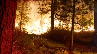
For firefighters, the first hour of a wildfire is crucial. A small ignition, if caught quickly, can often be contained and extinguished with minimal resources. However, if it goes undetected, a spark can explode into an uncontrollable megafire within
hours, threatening lives, homes, and entire ecosystems. Historically, detection has relied on a mix of public reports and watchtowers, methods that have clear limitations in remote areas. In recent years, repurposed weather and earth-observation satellites have helped, but they were never designed for this specific task. They often have low resolution or pass over the same spot too infrequently, meaning a fire can grow substantially between scans. This information gap is precisely what FireSat aims to close.
A Dedicated Eye in the Sky
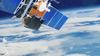
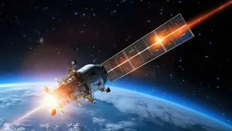
FireSat is the first satellite constellation purpose-built for wildfire detection. It is a collaborative effort involving the nonprofit Earth Fire Alliance, space systems company Muon Space, and technology giant Google, among other partners. Unlike existing systems, FireSat is not a side project for satellites with other primary missions. Its sole focus is to find fires. The plan involves a constellation of more than 50 satellites that, once fully operational, will scan nearly every point on Earth approximately every 20 minutes. The first prototype launched in March 2025, with the first three operational satellites following in the summer of 2026, marking the start of this ambitious project.
How the Technology Works
The power of FireSat lies in its combination of advanced hardware and intelligent software. Each satellite is equipped with a high-resolution multispectral infrared instrument. These sensors are specifically designed to detect heat signatures on the ground, day or night. But just spotting heat isn't enough; the system needs to distinguish a nascent wildfire from a barbecue or a sun-baked rock. This is where artificial intelligence comes in. The system’s AI compares new infrared images with thousands of previous images of the same location, taking into account factors like weather conditions to identify anomalies that indicate a real fire. This allows it to detect fires as small as 5x5 meters—about the size of a small classroom—with a false positive rate of less than five percent.
From Orbit to First Responders
Detecting a fire is only half the battle; the information must reach firefighters on the ground almost instantly. The FireSat system is designed for speed. Once the AI flags a probable fire, an alert can be sent to emergency responders, providing a near real-time common operating picture of the fire's location and boundary. This rapid data delivery can dramatically shorten the response time, giving fire crews a crucial head start. The project was developed in consultation with over 200 firefighters and incident commanders to ensure the data is delivered in a way that integrates with their existing workflows. Government agencies like CAL FIRE are early adopters, collaborating to test and refine the data products to maximize their effectiveness in the field.
The Future of Firefighting
FireSat represents a significant leap forward, but it is part of a broader trend of integrating advanced technology into wildfire management. Companies like Lockheed Martin are also developing AI-driven platforms like EMBERPOINT to better predict and track fire paths. Ground-based camera networks that use AI to scan for smoke are also becoming more common and can work in tandem with satellite systems. The ultimate goal of these technologies is not just to fight fires more effectively, but to prevent small incidents from becoming catastrophic disasters. By providing earlier and more accurate warnings, systems like FireSat have the potential to save billions of dollars in damages, protect fragile ecosystems, and, most importantly, safeguard human lives.