






Eyes in the Sky for Fishermen
Fishing across India's vast 8,100-kilometre coastline is a challenging task for the seven million people who depend on it for their livelihood. Traditionally, locating fish shoals involved long hours of searching, consuming significant time and expensive
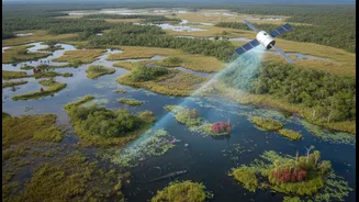
fuel, with no guarantee of success. This uncertainty is now being systematically reduced by a remarkable application of space technology. The Indian National Centre for Ocean Information Services (INCOIS), under the Ministry of Earth Sciences, provides daily advisories that guide fishermen to Potential Fishing Zones (PFZ). These advisories are essentially treasure maps for fishermen, created by interpreting data from satellites that continuously monitor the ocean's surface. By combining different data points, scientists can pinpoint areas where fish are most likely to congregate, transforming a game of chance into a strategic operation.
Reading the Ocean's Colour
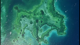
One of the key parameters used is ocean colour. Satellites can measure the greenness of the water, which indicates the concentration of chlorophyll, the pigment in microscopic marine plants called phytoplankton. These tiny organisms form the base of the marine food chain. Areas rich in phytoplankton attract zooplankton, which in turn attract small baitfish, and these baitfish are prey for larger, commercially valuable fish. However, the relationship isn't as simple as 'more green means more fish.' Water that is too murky and has extremely high chlorophyll concentrations can be low in oxygen and unfavourable for many species. The most productive fishing spots are often found at the boundaries, or 'fronts,' where clearer, oxygenated water meets phytoplankton-rich water. These advisories help fishermen find that perfect balance.
Following the Temperature Trail
Sea Surface Temperature (SST) is another crucial piece of the puzzle. Different fish species have specific temperature ranges they prefer. Satellites equipped with infrared sensors can measure the temperature of the ocean's top layer with remarkable accuracy. Pelagic fish, which live in the open ocean, are particularly sensitive to these temperature variations. They will actively seek out waters that are comfortable for them. By identifying oceanic fronts—areas where masses of water with different temperatures meet—scientists can predict where fish are likely to be found. These temperature breaks often concentrate baitfish, making them prime hunting grounds for predators and, therefore, prime fishing grounds for humans. INCOIS integrates SST data into its PFZ advisories, helping fishermen target their efforts more effectively.
Understanding Ocean Highs and Lows
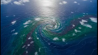
Perhaps the least intuitive factor is ocean height, also known as altimetry. The sea's surface is not perfectly flat; it has hills and valleys created by currents and temperature differences. Warmer water expands and creates areas of slightly higher sea level, while cooler water contracts, creating depressions. These variations can reveal powerful ocean features like eddies (swirling currents) and upwellings. Upwelling zones, where deep, cold, nutrient-rich water rises to the surface, are particularly important. These nutrients fuel explosive phytoplankton growth, kickstarting the entire food web. By using altimetry data to identify these dynamic areas, scientists can add another layer of precision to their fish forecasts, guiding fishermen to temporary hotspots of marine life.
The Real-World Impact
The integration of these three data streams—colour, temperature, and height—results in the daily PFZ advisories that are disseminated to lakhs of fishermen across India in their native languages via various means, including SMS and electronic display boards at harbours. The benefits have been transformative. Fishermen report significant reductions in searching time, which leads to massive savings on diesel fuel. Studies have shown that fishing in these notified zones results in a much higher catch per unit of effort compared to fishing outside them. A survey by the National Council of Applied Economic Research found that successful trips using PFZ advisories generated significant additional income for fishermen. This technology not only boosts the economic status of coastal communities but also contributes to national food security and makes the fishing industry more sustainable by reducing its carbon footprint.