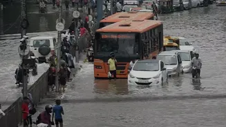










A Deluge Beyond the Forecasts
In the first days of August, a sudden, ferocious spell of rain caught many by surprise. While the India Meteorological Department (IMD) had indeed issued Red Alerts—signifying the potential for extremely heavy rainfall exceeding 204 mm in 24 hours—the
sheer intensity and speed of the downpour were staggering. What was an orange alert at 10 p.m. on July 31 dramatically escalated within hours. Some areas in the central districts of Idukki, Pathanamthitta, and Kottayam received over 30 cm (300 mm) of rain in just eight hours, a near-cloudburst event that weather models struggled to pinpoint with accuracy. This wasn't just heavy rain; it was a concentrated deluge that overwhelmed drainage systems and saturated the soil almost instantly, turning placid rivers into raging torrents. Between August 1 and 4, Kerala received 181% excess rainfall, recording 205.8 mm against a normal of 73.2 mm.
The Gap Between Prediction and Reality
So, why the disconnect? Modern weather forecasting is incredibly sophisticated, but it has limitations, especially with highly localized, rapid-onset events. Meteorologists noted that a combination of factors, including strong westerly winds and a significant difference in atmospheric pressure, created the perfect storm for this extreme weather. However, predicting the exact locations and the precise, explosive intensification of these events remains a major challenge. Chief Minister V.D. Satheesan noted that the IMD could not provide timely alerts for the sheer intensity due to the peculiar nature of the rainfall. What was flagged as a possibility for heavy rain quickly morphed into a catastrophic downpour over a very specific, limited area, a phenomenon that standard forecasting models often fail to capture until it's already unfolding. This highlights a crucial vulnerability in disaster preparedness: while we can anticipate the storm, predicting its full, localized fury is another matter entirely.
Cascading Consequences on the Ground
The impact of this forecasting gap was devastating and immediate. The torrential rain triggered a series of landslides in the vulnerable high ranges of Idukki and Kottayam. Rivers like the Pamba, Meenachil, and Manimala swelled, inundating low-lying towns such as Ranni and flooding vast agricultural plains. By August 5, the grim toll stood at 28 confirmed deaths, with several people still missing. More than 27,000 people were forced to abandon their homes, seeking shelter in over 460 relief camps set up across the state. The scenes were reminiscent of the catastrophic 2018 floods, with highways submerged, houses destroyed, and rescue teams from the National Disaster Response Force (NDRF) working tirelessly in hazardous conditions. The state government announced compensation for the victims, but the agricultural losses, estimated initially at over ₹67 crore, are expected to climb.
A New Pattern of Climate Uncertainty
This event is more than just an isolated weather anomaly; experts see it as part of a disturbing trend. Climate change is making weather patterns more erratic and intense. Ironically, this deluge followed a period where districts like Idukki and Wayanad had reported significant rainfall deficits for the monsoon season. This 'all or nothing' pattern—long dry spells punctuated by sudden, extreme rainfall—is becoming a hallmark of Kerala's changing monsoon. Studies show that while Kerala's total annual rainfall hasn't necessarily increased, it is becoming more concentrated into short, violent bursts. This intensity, combined with man-made factors like deforestation, quarrying, and sediment-filled rivers that have reduced water-carrying capacity, creates a recipe for repeated disasters. The recent floods are a stark reminder that preparing for climate change isn't just about managing more water, but about building resilience against unprecedented intensity.