






A New Eye Fixed on India
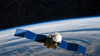
EOS-05, also known as GISAT-1A, is a state-of-the-art Earth observation satellite. Unlike most of its predecessors that circle the globe in Low Earth Orbit (LEO), EOS-05 operates from a much higher geostationary orbit (GEO), approximately 36,000 kilometres
above the equator. Satellites in LEO orbit the Earth rapidly, typically in 90 to 120 minutes, meaning they pass over a specific location periodically. In contrast, a GEO satellite matches the Earth's rotation, allowing it to remain fixed over the same geographic region. This makes EOS-05 India's first imaging satellite to maintain a constant watch over the Indian subcontinent and its surrounding oceans, a fundamental shift from the periodic snapshots provided by previous satellites.
The Geostationary Advantage: Real-Time Monitoring
The primary advantage of a geostationary orbit is the ability to provide near real-time imagery. Where LEO satellites like the Cartosat and RISAT series provide high-resolution images but with a time gap between revisits, EOS-05 can image the entire Indian landmass roughly every 30 minutes. For select areas of interest, it can provide updates as frequently as every five minutes. This capability for 'persistent monitoring' is a significant leap forward. It transforms satellite imaging from a tool for periodic assessment into a dynamic, 24/7 watchtower, enabling authorities to track rapidly evolving situations on the ground as they happen.
A Game-Changer for Disaster Management
For a country prone to natural disasters, this new capability is invaluable. During fast-moving events like cyclones, floods, and forest fires, timely information is critical to saving lives. EOS-05 can continuously track the formation and movement of cyclones, monitor flood inundation in real-time, and detect the spread of large fires. This constant stream of data allows for more accurate early warnings, helps authorities plan efficient evacuation routes, and guides rescue and relief operations with up-to-the-minute situational awareness. The satellite's advanced sensors, which include multispectral and hyperspectral imagers, provide detailed information on everything from cloud patterns to land and water body status.
Enhancing National and Economic Security
Beyond civilian applications, EOS-05 significantly bolsters India's strategic capabilities. The ability to maintain a constant vigil over land and sea borders provides a crucial advantage for national security, allowing for the monitoring of vast and difficult terrains. Any changes or unusual activities can be detected far more quickly than with intermittent satellite passes. Economically, the satellite's frequent updates are a boon for agriculture, forestry, and water resource management. It enables better monitoring of crop health, water levels in reservoirs, and changes in land use, leading to more informed decision-making in vital economic sectors.
A Key Piece in a Larger Constellation
EOS-05 does not replace India's existing fleet of Earth observation satellites but complements them. India operates one of the world's largest constellations of remote sensing satellites, including the Cartosat series for high-resolution mapping and the all-weather RISAT series with radar imaging capabilities. EOS-05 adds a new dimension to this system. While LEO satellites provide the fine-detail imagery, EOS-05 provides the broad, continuous overview. This integrated, multi-orbit approach creates a more resilient and comprehensive observation network, allowing ISRO to use the best tool for each specific task, whether it's detailed mapping, all-weather surveillance, or real-time monitoring.