




A Landscape of Hidden Danger
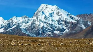
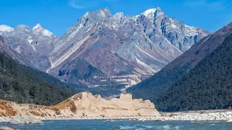
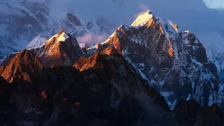
The Himalayas, often called the 'Third Pole', are home to thousands of glaciers. As global temperatures rise, these glaciers are melting at an accelerated rate. This meltwater often pools into vast glacial lakes, precariously held back by natural dams
made of loose rock and debris called moraines. These moraine dams are inherently unstable. Nepal alone has over 2,000 glacial lakes, with at least 21 considered potentially dangerous. This creates a landscape where billions of litres of water sit waiting for a trigger, turning a breathtaking vista into a high-altitude threat for millions living downstream in Nepal, Tibet, China, and India.
The Mistake of the Seismic Signal
In the immediate aftermath of a recent catastrophic flood on August 26, 2026, initial reports from officials suggested an earthquake was the trigger. Seismometers in the region had indeed recorded a significant seismic event. However, further analysis by the U.S. Geological Survey (USGS) and other geologists flipped this conclusion on its head. They determined that there was no tectonic earthquake. Instead, the seismic waves, registering as a magnitude 5.2 event, were generated by the disaster itself: a colossal chunk of a glacier and the underlying bedrock breaking free and crashing nearly 1.2 kilometres down into the valley below. The landslide didn't follow the tremor; the landslide was the tremor.
Location: Not All Lakes Are Equal
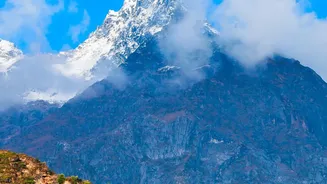
The specific location of a glacier or glacial lake is a critical factor in its potential for disaster. The catastrophic August 2026 event originated from a glacier collapsing on the north side of Langtang Lirung mountain, near the Nepal-Tibet border. Scientists noted that not only did a massive piece of the glacier break off, but a larger section of the mountain's bedrock failed with it. The stability of the underlying geology and the steepness of the terrain determine how vulnerable a glacier is. Furthermore, its proximity to downstream communities is crucial. Even a moderate event at a high altitude can transform into a devastating debris flow that travels tens of kilometres, sweeping away entire villages, roads, and bridges.
Timing: The Role of Seasons and Climate
The timing of such a collapse can amplify its destructive power exponentially. Many of these events occur during the monsoon season, when river levels are already high and the ground is saturated with rain. This means the landscape has a reduced capacity to absorb any additional water. In the case of the August 2026 flood, satellite imagery suggested that significant snow had melted in the 24 hours prior, indicating warm conditions that could have further destabilised the ice. Climate change is a key driver, making the region's glaciers disappear 65% faster between 2011 and 2020 than in the previous decade. This warming degrades permafrost, the frozen 'glue' that holds steep mountain slopes together, making collapses more likely.
A Deadly Cascade of Events
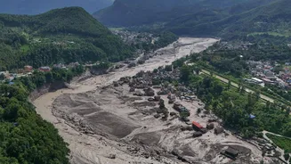
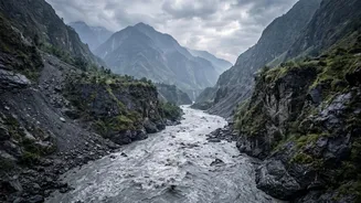
The analysis reveals a terrifying chain reaction. First, a warming climate destabilises a high-altitude glacier. Second, a massive section of ice and rock breaks loose from a vulnerable location, generating its own seismic waves as it falls. The sheer force of this impact can pulverise the ice into a fast-moving mix of water and debris. This initial torrent can then block a river downstream, forming a temporary dam. When this debris dam inevitably fails, it releases a catastrophic flood wave, picking up more boulders and sediment as it scours the valley floor, compounding the destruction for communities miles away.