








What Happened in Nepal?
On Wednesday, August 26, 2026, a massive flash flood surged through the Bhote Koshi river system in northern Nepal, near the border with Tibet. The event began without warning, sending a torrent of muddy water and debris through the districts of Rasuwa,
Nuwakot, and Dhading, sweeping away buildings, bridges, and roads. The disaster caused catastrophic loss of life and infrastructure, with hundreds reported dead or missing, including a large number of foreign tourists and pilgrims. Initial reports were confused, with some suggesting an earthquake, but analysis later confirmed the seismic signal was generated by a massive landslide or glacial collapse, not a tectonic event.
A Cascading Himalayan Catastrophe
Scientists believe the disaster was a cascading event, a chain reaction of hazards becoming increasingly common in the warming Himalayas. The most likely trigger was the collapse of a large hanging glacier or a massive rock-ice avalanche in the high mountains. This collapse sent an immense volume of material crashing into the valley, which likely created a temporary dam on the Lhende Khola or Bhote Koshi river. When the pressure of the backed-up water became too great, this natural dam breached, releasing the entire volume at once in a destructive pulse that traveled rapidly downstream. This phenomenon, a type of outburst flood, carries immense power, capable of destroying concrete structures and reshaping the landscape in minutes.
The Threat Moves Downstream to India
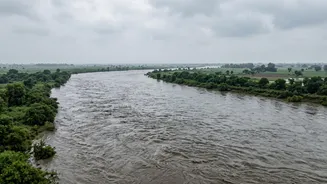
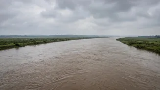
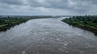
Natural disasters do not respect political borders. The floodwaters that began in Nepal's mountains are now travelling down an interconnected river system that flows directly into India. The flood surge moved from the Bhote Koshi and Trishuli rivers in Nepal into the Narayani river system. The Narayani becomes the Gandak river when it enters India, flowing through the densely populated states of Uttar Pradesh and Bihar before eventually joining the Ganga. This direct hydrological link means that a disaster unfolding hundreds of kilometres away in Nepal poses an imminent threat to Indian villages and towns.
Indian States on High Alert
In response to urgent notifications from Nepal, authorities in India have been put on high alert. India's Central Water Commission issued warnings for a potential surge in the Gandak river. State governments in Bihar and Uttar Pradesh have begun taking precautionary measures, with a particular focus on districts bordering Nepal like West Champaran, East Champaran, Maharajganj, and Kushinagar. As a preventive step, officials in Bihar opened all 36 gates of the Gandak Barrage at Valmikinagar to manage the expected increase in water flow. The National Disaster Response Force (NDRF) has deployed teams to vulnerable areas, and evacuations of low-lying communities have begun as authorities closely monitor rising river levels.
A Test for Cross-Border Cooperation
This event highlights the critical importance of cross-border disaster management between India and Nepal. The two countries have existing mechanisms for sharing hydrological and meteorological data, which are crucial for flood forecasting. During the monsoon season, data from Nepal is updated hourly and fed into flood control rooms in Lucknow and Patna. However, the increasing frequency of sudden, extreme events like this one is testing the limits of these systems. Experts argue that cooperation must evolve from simply sharing flood warnings to integrated, basin-wide risk management that includes real-time impact forecasting, better monitoring of glacial risks, and more effective community-level alert systems to save lives on both sides of the border.