






A Flawless Predawn Liftoff
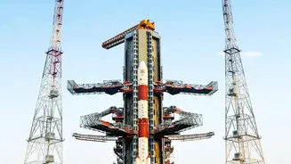
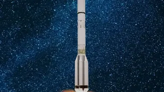
On September 4, 2026, the 51.7-metre-tall Geosynchronous Satellite Launch Vehicle (GSLV-F17) soared into the sky from the Satish Dhawan Space Centre in Sriharikota. The powerful three-stage rocket, weighing 420.5 tonnes, performed perfectly, marking the 19th
flight for the GSLV programme. This successful launch was a significant moment for ISRO, demonstrating the reliability of its heavy-lift launch vehicle and concluding a nearly eight-month interval between launches.
Mastery of Cryogenic Technology
A critical element of the GSLV's success is its indigenous cryogenic upper stage (CUS). This advanced stage uses super-cooled liquid hydrogen and liquid oxygen as propellants, providing the immense thrust required to place heavy satellites into high orbits like the Geosynchronous Transfer Orbit (GTO). The flawless performance of the CUS15 stage on this mission was particularly noteworthy, as it reaffirmed India's mastery over this complex technology, which is crucial for achieving self-reliance in launching heavy payloads. The mission's success also helped overcome the memory of the GSLV-F10 failure in 2021, which was caused by an anomaly in its cryogenic stage.
India’s First Geo-Imaging Satellite
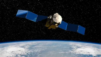
The mission's primary passenger, EOS-05, is not just another satellite; it's India's first imaging satellite designed to operate from a geosynchronous orbit, approximately 36,000 km above the Earth. Unlike satellites in Low Earth Orbit (LEO) that pass over a location intermittently, a satellite in a geostationary orbit moves at the same speed as the Earth's rotation. This allows EOS-05 to continuously monitor a large portion of the Indian subcontinent, providing a persistent 'eye in the sky'.
Precision Orbit and a Performance Bonus
Just over 18 minutes after liftoff, the GSLV-F17 injected the 2,367 kg EOS-05 satellite into its intended Sub-Geosynchronous Transfer Orbit. In fact, the rocket performed even better than expected, placing the satellite at an apogee (its farthest point from Earth) about 2,000 km higher than planned. This 'bonus' altitude means the satellite will need to use less of its own onboard fuel for the subsequent orbit-raising manoeuvres required to reach its final circular orbit, potentially extending its operational life. Orbit-raising burns were successfully initiated in the days following the launch to position the satellite correctly.
A Boost for Disaster Management
One of the most significant applications of EOS-05 will be in near real-time disaster management. Its ability to provide repeated images of a large area at short intervals will be invaluable for tracking the rapid development of cyclones, monitoring flood inundation, and observing forest fires. This constant watchfulness can provide critical and timely data to emergency response agencies, helping them make informed decisions and save lives.
Enhancing Agriculture and National Security
Beyond disaster response, EOS-05 will serve a wide range of civilian and strategic purposes. Its multispectral imagers will collect data vital for agriculture, including monitoring crop health, soil moisture, and vegetation changes. It will also aid in urban planning, forestry, and water resource management. Furthermore, the satellite's capability for continuous monitoring of the Indian subcontinent and its maritime boundaries provides a significant strategic advantage, enhancing national security and border surveillance.