





The 'Original Story': A New Eye in the Sky
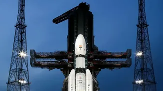
The story of EOS-05, a state-of-the-art Earth observation satellite, began with its successful launch aboard a GSLV rocket on September 4, 2026. This was not just another launch for the Indian Space Research Organisation (ISRO); it marked a significant
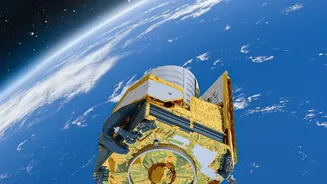
strategic advancement. EOS-05 was India's first imaging satellite designed to operate from a Geosynchronous Orbit (GEO), approximately 36,000 kilometres above the Earth. Unlike previous observation satellites in Low Earth Orbit (LEO) that circled the planet rapidly, EOS-05 was designed to hover over the Indian subcontinent, providing continuous, near-real-time surveillance. This capability to stare at a large geographical area was a game-changer, promising to revolutionize everything from disaster management to strategic monitoring. The 'original story' was one of immense promise: a dedicated eye in the sky for India.
Beyond a Single Glance: Unprecedented Capability
What makes the EOS-05 mission so powerful are its advanced imaging systems. Equipped to observe the Earth across multiple spectrums—including visible, infrared, and hyperspectral bands—the satellite can see far more than the human eye. This allows it to gather diverse types of information simultaneously. For instance, it can track the development of cyclones, monitor the health of forests, detect changes in water bodies, and observe agricultural patterns all from its fixed position in the sky. This constant watchfulness is its key strength. While LEO satellites provide high-resolution snapshots, they can only revisit a specific location after a certain interval. EOS-05, by contrast, offers persistence. It can provide a stream of images during a rapidly developing flood or monitor borders for unusual activity without interruption, a capability previously unavailable to Indian agencies from a single platform.
A Guardian for National Security
One of the most critical and enduring roles of EOS-05 is its contribution to national security. The ability to maintain a constant vigil over the Indian subcontinent and its maritime interests is a significant strategic asset. The satellite's data provides invaluable intelligence for monitoring borders, tracking vessel movements in the Indian Ocean, and supporting the operational needs of the armed forces, including the Indian Navy. This constant stream of high-quality imagery helps in maintaining situational awareness and allows security agencies to respond more effectively to emerging threats. While much of this work happens away from the public eye, it forms a core part of why the satellite's mission remains profoundly relevant. It acts as an unseen guardian, enhancing India's strategic autonomy and bolstering its defence capabilities from a unique vantage point high above.
From Cyclones to Crops: A Lifeline for Civilians
Beyond its strategic importance, EOS-05 has proven to be a vital tool for civilian applications, touching the lives of millions. Its most significant impact is in the realm of disaster management. By providing near-real-time imagery of weather systems, the satellite is crucial for tracking the formation and intensification of cyclones, allowing for more accurate predictions and timely evacuations. Similarly, it aids in monitoring large-scale events like floods and forest fires, enabling faster and more coordinated responses. The satellite’s data is also a boon for agriculture, helping to assess crop health, monitor water resources for irrigation, and forecast yields. This information empowers policymakers and farmers alike, contributing to food security and better resource management. The mission's 'legs' are firmly planted in this tangible, real-world impact that helps protect lives and livelihoods across the country.