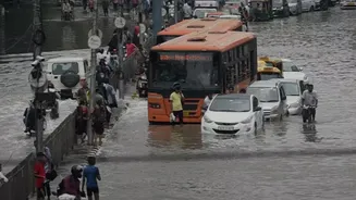









From Downpour to Deluge
In the first days of August, several districts across central and northern Kerala were hit by an astonishing amount of rain. This wasn't the steady, predictable monsoon drizzle. Instead, weather stations recorded cloudburst-like events, with some areas
receiving over 300 mm of rainfall in a single 24-hour period. This is more than three times the normal average for this time. The result was immediate and catastrophic. Rivers like the Pamba, Meenachil, and Manimala, which are lifelines for the region, swelled in an instant, breaching their banks and sending walls of water into towns and villages in districts like Pathanamthitta, Idukki, and Kottayam. Roads disappeared, homes were inundated, and entire communities were cut off as the landscape was violently transformed.
The Science of a Sudden Storm
So, what caused such a sudden and intense burst of rain? Meteorologists point to a perfect storm of atmospheric conditions. A combination of strong westerly winds, laden with moisture from the Arabian Sea, slammed into the Western Ghats. The mountain range acts like a giant wall, forcing this moist air to rise rapidly. As it rises, it cools and condenses, forming massive, towering cumulonimbus clouds that can be up to 15 kilometres tall. These clouds are capable of holding enormous amounts of water. Instead of releasing it gradually, strong upward air currents kept the water suspended until the clouds became oversaturated, finally dumping their entire load in a very short, concentrated period. This phenomenon, known as an extreme precipitation event, is what leads to the 'within hours' timeline of the disaster.
A Land Made for Landslides
The danger isn't just from the sky; it's also rooted in the very land itself. Kerala's high-range districts are characterized by steep, sloping terrain. When rain of this intensity hits, the ground simply cannot absorb the water fast enough. The soil becomes saturated, and the excess water turns into powerful surface runoff. On these steep slopes, that runoff quickly gains momentum, gathering debris and turning into deadly flash floods. Furthermore, the soil composition in many parts of the Western Ghats, when completely waterlogged, loses its cohesive strength. This makes the slopes incredibly unstable and prone to collapse, triggering the devastating landslides that have claimed lives in places like Idukki and Kottayam.
The Human Fingerprint
While nature provided the trigger, years of human activity have loaded the gun. Experts have repeatedly warned that rampant and often unregulated construction, quarrying, and deforestation in the fragile ecosystem of the Western Ghats have significantly increased the risk of disaster. These activities destabilize slopes, obstruct natural drainage patterns, and remove the tree cover that helps bind the soil and absorb rainwater. Reports like the one from the Madhav Gadgil-led panel had identified many of these areas as ecologically sensitive zones, recommending strict regulation on development. The recent events are a tragic reminder of the consequences of ignoring such ecological warnings. A landscape weakened by human intervention is far less resilient to the shocks of extreme weather.
Why Speed Is the True Enemy
The sheer speed of these events is what makes them so lethal. Unlike riverine floods that may build over days, these flash floods and landslides offer almost no warning time. Communities are engulfed before evacuation orders can be fully implemented or, in some cases, even issued. The same torrents of water and debris that destroy homes also wash away roads and communication lines, isolating villages and severely hampering the efforts of rescue teams like the NDRF and local services to reach the affected. This is why a few hours of intense rain can lead to dozens of fatalities and force thousands into relief camps, as seen in the latest disaster where over 18,000 people were evacuated.