





What Exactly Happened?
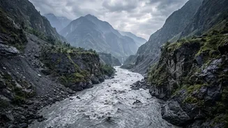
On the morning of August 26, a massive flash flood surged down the Lhende Khola and Bhotekoshi river valleys, impacting communities in both Nepal and China. The wall of water, mud, and boulders moved with incredible speed and force, with water levels
in Trishuli river rising by as much as nine metres in just 30 minutes. The deluge swept away buildings, bridges, and roads, causing hundreds of casualties and leaving many more missing. The sheer power of the event was so great that initial reports mistook its impact for an earthquake.
A Glacier Collapse, Not an Earthquake
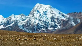
Early reports suggested a magnitude 4.4 earthquake triggered the disaster. However, scientists at the U.S. Geological Survey (USGS) quickly revised this assessment. After analyzing seismic data, they concluded the tremors were not tectonic in origin but were instead generated by the impact of a massive landslide. The event was reclassified as a magnitude 5.2 seismic event caused by a colossal collapse of ice and rock from a glacier high on Langtang Lirung, a 7,000-metre peak. According to analysis of satellite imagery, a huge section of a glacier and the bedrock beneath it gave way, falling about 1,200 meters into the valley below.
How Did Ice and Rock Turn into a Flood?
The sequence of events was swift and catastrophic. The massive rock and ice avalanche slammed into the Lhende Khola river valley. This impact likely created a temporary dam, blocking the river's flow. As water built up rapidly behind this unstable barrier, the pressure mounted until the dam failed, releasing a sudden, violent surge downstream. The immense kinetic energy from the fall, combined with the collected water and debris, transformed into the devastating debris flow that resembled liquid concrete, making it impossible to outrun.
The Role of a Warming Climate
While scientists are careful not to attribute any single event solely to climate change, they agree it is a major contributing factor creating unstable conditions. The Himalayan region is warming about twice as fast as the global average. This rapid warming thaws permafrost—the frozen soil and rock that acts like glue holding mountainsides together—and accelerates glacier melt. Nepal has lost nearly a third of its ice volume in just over three decades. These warming conditions weaken the bonds between ice and rock, making catastrophic collapses like this one more frequent. This disaster follows a pattern of similar events in the Himalayas, including the 2021 Chamoli flood in India.
What Are the Broader Risks for the Region?
This event is a stark reminder of the growing dangers faced by the nearly 2 billion people who live downstream from Himalayan-fed rivers. The accelerated melting is not only increasing the risk of avalanches and floods but also leading to the rapid growth of glacial lakes. There are now hundreds of potentially dangerous glacial lakes in the region that could burst their natural dams, creating what are known as Glacial Lake Outburst Floods (GLOFs). These hazards threaten communities and critical infrastructure, including hydropower projects, in Nepal, India, China, and other neighbouring countries. For India, the health of these glaciers is vital, as they feed major river systems like the Ganges, which supports hundreds of millions of people.