







The Standard El Niño Effect
First, let's understand the basics. El Niño is a climate pattern defined by the unusual warming of surface waters in the central and eastern equatorial Pacific Ocean. This large-scale warming disrupts global atmospheric circulation. For India, this typically
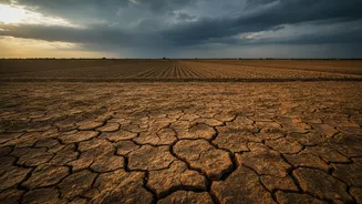
means a weaker monsoon. The phenomenon can suppress the development of rain-bearing clouds and reduce the moisture carried from the sea to the subcontinent, often resulting in below-average rainfall during the crucial southwest monsoon season. Historically, many of India's most severe droughts have coincided with strong El Niño years. This link is why its forecast immediately puts the agricultural sector, which relies heavily on monsoon rains, on high alert.
The Indian Ocean's Own Weather Engine
While El Niño is a powerful force in the Pacific, the Indian Ocean has its own climate see-saw that can either help or hinder our monsoon: the Indian Ocean Dipole, or IOD. The IOD has three phases. In a 'negative' phase, conditions worsen, often complementing El Niño's drying effect. But in a 'positive' phase, the western Indian Ocean near Africa becomes warmer than the eastern part near Indonesia. This temperature difference pushes more moisture-filled air towards the Indian subcontinent, actively boosting the monsoon. A strong positive IOD can act as a saviour, powerful enough to counteract the negative effects of an El Niño. The famous case was in 1997, when a super El Niño was expected to cause a massive drought, but a strong positive IOD developed concurrently, resulting in a normal monsoon for India.
Why Distribution Trumps Total Volume
A key detail often lost in monsoon forecasts is the difference between total rainfall and its distribution. A season might be declared 'normal' based on the total volume of rain, but this can be misleading. If most of that rain falls in a few massive downpours, it can cause floods in some areas while leaving others dry for weeks, devastating crops. For agriculture, what truly matters is steady, evenly distributed rainfall throughout the season. Crops need moisture at specific stages of their growth cycle. A long dry spell in the middle of the growing season, particularly in August, can slash yields even if the country's overall rainfall figures look healthy. This is why farmers watch the daily and weekly patterns of rain far more closely than the seasonal forecast. Spatially even rainfall across key farming regions is more beneficial than isolated, intense deluges.
The Critical Importance of Timing
The timing of the monsoon's arrival and withdrawal is just as critical as the amount of rain it brings. The sowing of essential Kharif crops like rice, soybean, pulses, and cotton is synchronised with the monsoon's onset, which typically occurs in June. A delay of even a couple of weeks can force farmers to postpone sowing, which can reduce crop yields significantly. Studies have shown that a 10-day delay in the monsoon's arrival can reduce the yield of some crops by over 4%. Furthermore, the timing of rainfall within the season affects everything from germination to flowering. An early withdrawal of the monsoon can leave late-maturing crops thirsty at the most crucial stage of their development, impacting both the quantity and quality of the final harvest.