








The Power of a Fixed Gaze
Most earth observation satellites circle the globe in Low Earth Orbit (LEO), capturing snapshots of different locations as they pass overhead. While useful, they have a significant limitation: it can take hours or even days for them to revisit the same
spot. A geosynchronous satellite is different. Placed at a very high altitude of nearly 36,000 kilometres, its orbit is synchronized with the Earth's rotation. This allows it to remain seemingly fixed over a specific region, providing a constant, unwavering view. This capability is a game-changer for monitoring rapidly developing events like cyclones, floods, or forest fires, where near-real-time information is critical. Instead of periodic updates, it offers persistent observation.
EOS-05: The Ambitious 'Eye in the Sky'
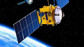
EOS-05, also known as GISAT-1A, was designed to be India's first satellite to provide this powerful geosynchronous imaging capability. It was a state-of-the-art spacecraft equipped with high-resolution multispectral and hyperspectral imagers. These instruments would allow it to see across various wavelengths of light, including visible and infrared, enabling a wide range of applications. The plan was for EOS-05 to capture images of the entire Indian subcontinent every 30 minutes, with the ability to focus on priority areas as frequently as every five minutes. This 'eye in the sky' was intended for both civilian and military use, from tracking weather systems and managing natural resources to strengthening surveillance along India's borders.
A Setback in the Stratosphere
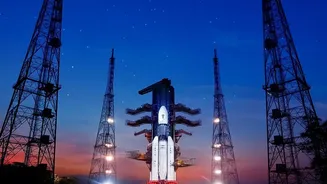
The journey to establishing this capability has faced significant challenges. In August 2021, the original mission to launch a satellite of this class, then called GISAT-1 (or EOS-03), ended in failure. The Geosynchronous Satellite Launch Vehicle (GSLV-F10) carrying the satellite lifted off successfully, but a technical anomaly in its cryogenic upper stage prevented the engine from igniting as planned. An investigation later revealed that a leak in a valve led to insufficient pressure in the liquid hydrogen propellant tank. The rocket was unable to deliver the satellite to its intended orbit, resulting in the loss of the mission. It was a significant setback for the Indian Space Research Organisation (ISRO) in its quest for this advanced observational asset.
Redemption and the Road Ahead
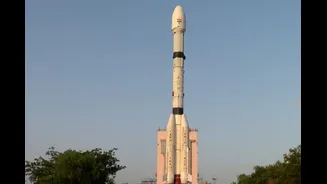
Despite the 2021 failure, ISRO's ambition remained undeterred. On September 4, 2026, ISRO successfully launched the EOS-05 satellite aboard a GSLV-F17 rocket. The launch was a success, placing the 2,367 kg satellite—the heaviest yet carried by a GSLV—into its intended sub-geosynchronous transfer orbit. From this intermediate orbit, the satellite will use its own onboard propulsion system to perform a series of manoeuvres, gradually raising and circularising its path to reach its final position 36,000 km above Earth. This successful launch not only places a crucial asset in space but also serves as a testament to the resilience of the GSLV program, which had been nicknamed the 'naughty boy' for its early issues.
Why Geosynchronous Imaging Remains a Priority
The strategic importance of a satellite like EOS-05 cannot be overstated. For disaster management agencies, it means getting real-time information to respond faster to floods and cyclones. For agriculture, it offers a way to monitor crop health and water resources over large areas consistently. And for national security, it provides an invaluable layer of persistent surveillance over land and maritime domains, enhancing situational awareness without interruption. As former ISRO Chairman G. Madhavan Nair noted, such satellites are indispensable for modern security, where real-time intelligence is a determining factor. The successful deployment of EOS-05 places India in a select group of nations with this advanced capability, opening new avenues for both national development and security.