




A Pattern of Calamity
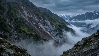
In recent years, the Himalayas have been sending increasingly violent signals. In late August 2026, catastrophic flash floods originating from a glacier collapse on the Nepal-Tibet border tore through river valleys, claiming hundreds of lives in both
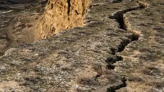
Nepal and China and leaving thousands missing. This was not an isolated event. It follows a grim pattern seen in the 2023 glacial lake outburst flood (GLOF) in Sikkim, where the South Lhonak lake breached its dam, causing a flood that killed dozens and washed away critical infrastructure like the Teesta-III hydropower dam. In Uttarakhand, the town of Joshimath continues its slow, terrifying subsidence, with hundreds of homes developing deep cracks as the very ground beneath them sinks. These events, along with the Chamoli disaster in 2021 and deadly floods in Nepal in previous years, form a terrifying mosaic of a region under extreme stress. They are no longer just “natural disasters” but symptoms of a deeper, systemic problem.
The Climate Change Accelerator
The primary force multiplier behind these disasters is climate change. The Hindu Kush Himalaya region is warming significantly faster than the global average. This accelerated warming has two devastating effects. First, it is causing glaciers to retreat and thin at an alarming rate, with some studies showing ice loss rates have doubled since 2000. This meltwater doesn't just disappear; it forms vast, unstable glacial lakes, often dammed by loose rock and debris known as moraines. As these lakes grow—the South Lhonak lake grew 12-fold between 1975 and 2023—the risk of a catastrophic GLOF increases dramatically. Second, warming thaws permafrost, the frozen ground that acts like glue holding mountain slopes together. When this permafrost thaws, entire rock faces and slopes can become unstable, leading to the massive landslides that can trigger these floods.
A Fragile Foundation Meets Unchecked Development
The Himalayas are the world's youngest and most geologically active mountain range, inherently prone to earthquakes, erosion, and landslides. This natural fragility is being dangerously amplified by human activity. A boom in infrastructure development—often unplanned and unscientific—is pushing this delicate ecosystem to its breaking point. Massive road-widening projects, like the Char Dham highway in Uttarakhand, involve cutting into the base of steep, fragile slopes, weakening them further. The proliferation of hydropower projects places heavy concrete structures and tunnels in narrow, vulnerable river valleys. Residents and experts alike have pointed to tunneling for the Tapovan Vishnugad project as a potential contributor to the subsidence in Joshimath. This rampant construction, coupled with deforestation and expanding settlements in high-risk zones, disrupts natural drainage patterns and removes the natural buffers that once absorbed rainfall, turning cloudbursts into deadly torrents of water and debris.
A Cross-Border Crisis Demands Cooperation
These disasters do not respect international borders. A glacier collapse in Tibet can send a flood surge down a river that devastates communities in Nepal and then flows into India. The August 2026 flood event highlighted this interconnectedness, affecting people and infrastructure across both Nepal and China and impacting Indian nationals caught in the disaster zone. This shared vulnerability underscores a critical need for transboundary cooperation. While some community-level early warning systems exist between India and Nepal, they are often not sufficient for the speed and scale of today's hazards. Experts are calling for a robust, real-time data-sharing framework between China, Nepal, and India on glacier stability, rainfall, and river flows. Such a system could provide crucial extra hours or even minutes of warning for downstream communities, giving them a chance to evacuate and save lives when disaster strikes.