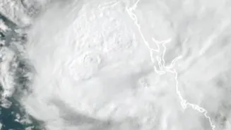







Akvan Intensifies, Landfall Expected Soon
The India Meteorological Department (IMD) has confirmed that Cyclonic Storm Akvan intensified into a Severe Cyclonic Storm on November 18. As of the latest reports, the storm is moving north-northwestwards over the west-central Bay of Bengal. Forecasts
predict it will make landfall along the North Andhra Pradesh and South Odisha coasts between Narsapur and Puri around noon on November 20. Authorities have issued warnings for sustained wind speeds of 90-100 kmph, with gusts potentially reaching 110 kmph, prompting an Orange Alert for the coastline. The slow movement of the storm is allowing it to gather more strength and moisture over the warm sea waters.
A Troubling Trio of Storms
The arrival of Akvan comes on the heels of two other recent cyclones, creating a rapid succession of weather threats for the region. Very Severe Cyclonic Storm Arnab formed in late October, making landfall in Andhra Pradesh and causing significant damage to crops and infrastructure. Shortly after, in early November, Severe Cyclonic Storm Murasu developed, also crossing the Andhra Pradesh coast near Ongole and bringing heavy rainfall. This sequence of three cyclones within such a short period during the post-monsoon season is unusual and highlights a period of heightened cyclonic activity in the Bay of Bengal. This season, which typically runs from October to December, is historically the most active and hazardous for the basin.
How Cyclones Get Their Names
The names of cyclones in the North Indian Ocean, including the Arabian Sea and Bay of Bengal, are assigned by the IMD from a list compiled by 13 member countries of the World Meteorological Organization (WMO) and UNESCAP panel. This practice helps in the clear and quick identification of storms in public warnings. The names 'Arnab', 'Murasu', and 'Akvan' were contributed by Bangladesh, India, and Iran, respectively. Once a name is used, it is retired and not used again. A storm is officially named when it intensifies into a cyclonic storm with wind speeds of at least 62 kmph.
States Brace for Impact
In anticipation of Akvan's landfall, both Andhra Pradesh and Odisha are ramping up preparations. The Andhra Pradesh government has placed several districts, including Kakinada, Visakhapatnam, and Vizianagaram, under red alert for November 20, expecting extremely heavy rainfall. Thirteen teams from the National Disaster Response Force (NDRF) and eleven from the State Disaster Response Force (SDRF) have been put on standby for rescue and relief operations. In Odisha, authorities are preparing for the storm's impact after it crosses the Andhra coast, with several southern districts like Malkangiri and Koraput on alert for heavy rains and strong winds. The government has also restricted tourism and recreational activities along the coast as a precautionary measure.
Understanding IMD's Warning System
The IMD follows a structured, four-stage warning system to alert the public and government agencies about developing cyclones. The first stage is a 'Pre-Cyclone Watch', issued 72 hours in advance. This is followed by a 'Cyclone Alert' 48 hours before impact. A 'Cyclone Warning' is issued 24 hours prior, providing specific details on the landfall point and expected intensity. Finally, a 'Post-Landfall Outlook' is given to predict the storm's movement and impact on interior areas. These warnings are communicated through various channels, including All India Radio and Doordarshan, to ensure maximum reach, especially to vulnerable coastal communities and fishermen.