





The Atmosphere's High-Speed River
First, let's talk about the jet stream itself. Imagine a fast-flowing river of wind, thousands of kilometres long, snaking its way around the planet about 10 kilometres above the surface. This isn't just one river, but several, with the most prominent
being the polar jet stream in the Northern Hemisphere. Its primary job is to act as a barrier, separating cold polar air from warmer air to the south. This boundary is created by the temperature difference between the equator and the poles, and the bigger the temperature difference, the stronger and straighter the jet stream flows. Its west-to-east path is what pushes our weather systems along, typically ensuring that a hot spell or a rainy day moves on after a few days.
When the River Gets Wavy
Things get interesting, and extreme, when this river of air stops flowing in a relatively straight line and develops deep, meandering curves. Scientists refer to this as the jet stream becoming 'wavier' or more 'amplified'. Instead of a swift current, it behaves more like a slow, looping river. These large north-south swings are often called Rossby waves. When these waves get big enough, they can slow down or even stall, creating what meteorologists call a 'blocking pattern'. This block prevents weather systems from moving along their usual path, effectively locking the weather in place for days or even weeks.
Creating a 'Heat Dome'
One of the most significant consequences of a blocking pattern is the formation of a 'heat dome'. When a wave in the jet stream creates a persistent area of high pressure, it acts like a lid on a pot. The high pressure causes air to sink, which compresses and heats it. This lid then traps the hot air at the surface, preventing it from rising and cooling off. With no cloud formation, the sun relentlessly bakes the ground, making the trapped air even hotter day after day. This is how you get prolonged, dangerous heatwaves where temperatures soar far beyond normal and refuse to drop.
A Global Phenomenon Unfolding Now
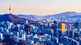
This isn't just a theoretical concept; it's the reality for millions of people right now. In early August 2026, a series of these blocking patterns are fueling simultaneous heatwaves across the globe. A major heat dome is parked over the Western United States, bringing temperatures of over 46°C to cities like Phoenix and Las Vegas and extending heat alerts as far north as Montana. Meanwhile, Europe is enduring another brutal summer, with a powerful heat dome locking in temperatures above 40°C over the Mediterranean, France, and Germany. In Asia, South Korea recently recorded its highest temperature in 122 years at 42.5°C, while parts of Egypt are forecast to approach a blistering 47°C. These are not isolated events but are connected by this larger atmospheric pattern.
Is Climate Change the Driver?
The big question scientists are tackling is the role of climate change in all this. The leading theory is that a rapidly warming Arctic is a key factor. The Arctic is warming much faster than the rest of the planet, which reduces the temperature difference between the pole and the tropics. A smaller temperature difference weakens the jet stream, making it slower and more prone to developing these large, sluggish waves. While some waviness is natural, many scientists believe climate change is making these persistent, extreme-weather-generating patterns more frequent and intense. Essentially, by altering the planet's temperature balance, we are changing the behavior of the atmospheric systems that govern our weather.