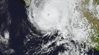






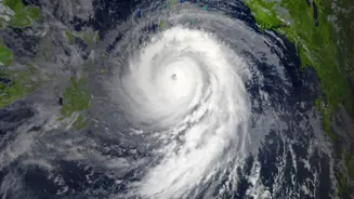
What is the Latest on Cyclone Akvan?
As of Thursday, November 19, Cyclone Akvan has intensified into a severe cyclonic storm and is moving over the west-central Bay of Bengal. The India Meteorological Department (IMD) is tracking its slow north-northwestward movement. The latest forecasts
predict it will make landfall around noon on Friday, November 20. The exact point of crossing is expected to be between Narsapur in Andhra Pradesh and Puri in Odisha. While earlier predictions suggested it could become a 'very severe cyclonic storm', the IMD now expects it to cross the coast as a 'severe cyclonic storm' with sustained wind speeds of 90-100 kmph, gusting up to 110 kmph.
Which States are on High Alert?
The primary states on alert are Andhra Pradesh and Odisha, which lie in the storm's direct path. An 'Orange' alert, which means 'Be Prepared', has been issued for the coastal regions of both states. In Andhra Pradesh, districts including Prakasam, Krishna, West Godavari, Kakinada, and Visakhapatnam are on high alert, with warnings of a storm surge of up to two metres that could inundate low-lying areas. The Odisha government has also taken extensive measures, particularly in southern districts like Ganjam, Gajapati, Rayagada, Malkangiri, and Koraput. Heavy rainfall is also expected in parts of West Bengal and Telangana.
How are Authorities Preparing?
Both central and state governments have initiated large-scale disaster response protocols. The National Disaster Response Force (NDRF) has pre-emptively deployed multiple teams across the vulnerable states. In Odisha, 8 NDRF teams have been stationed in six districts, while Andhra Pradesh has 13 NDRF and 11 State Disaster Response Force (SDRF) teams ready for emergency operations. Senior IAS officers, some with prior experience in cyclone management, have been sent to vulnerable districts in Odisha to oversee preparedness. Evacuation of people from low-lying and coastal areas has begun, with tens of thousands being moved to cyclone shelters. Schools in several districts have been closed, and government employees' leaves have been suspended to ensure availability.
What Do the Warnings Mean for Residents?
The IMD uses a colour-coded system to communicate the severity of weather events. An 'Orange' alert, currently in place, signifies that extremely bad weather is expected and people should be prepared for disruptions like power outages and travel closures. A 'Red' alert, which signifies 'Take Action', has been issued for rainfall in some coastal districts, warning of very heavy to extremely heavy downpours on November 19 and 20. Residents in affected areas are advised to secure their homes, prepare emergency kits with essentials, and follow all instructions from local authorities. Fishermen have been strictly warned not to venture into the sea until November 21.
How to Stay Safe and Informed
It is crucial to rely on official sources for information, such as bulletins from the IMD and advisories from state disaster management authorities. Andhra Pradesh has activated several toll-free emergency numbers, including 112, 1070, and 18004250101, for immediate assistance. Issues like power cuts and fallen trees can also be reported via a dedicated WhatsApp number. Officials have urged people in low-lying areas to move to designated relief centres without delay when instructed. Farmers have been advised to harvest mature crops to prevent damage, and residents in all coastal areas are urged to stay indoors and avoid unnecessary travel during the storm.