





Not All Rain Is Created Equal
When we think of rain, we might picture a simple cycle of evaporation and precipitation. In reality, there are two primary pathways for rain formation inside clouds. The most commonly understood method is the 'cold cloud' process, where supercooled water
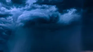
droplets and ice crystals interact high in the atmosphere. The ice crystals grow, become heavy, and fall, often melting into rain on their way down. However, in the tropics, another process dominates: 'warm-cloud' rain. These clouds are composed entirely of liquid water droplets, with no ice involved. Rain forms through a process called collision-coalescence, where countless tiny droplets bump into each other and merge, growing larger and larger until they are heavy enough to overcome updrafts and fall to the ground. This type of precipitation is crucial to the tropical water cycle.
The Warm-Cloud Puzzle
Despite their importance, warm clouds have long been a puzzle for meteorologists. Their rain-making process is incredibly complex and happens on a microscopic scale, making it difficult to observe and simulate accurately in climate models. Global models have historically struggled to represent the true depth and strength of tropical clouds, leading to significant uncertainties in long-term climate projections. One of the biggest question marks has been the role of aerosols—tiny particles in the atmosphere from sources like dust, sea salt, or man-made pollution. These particles act as seeds for cloud droplets. For decades, scientists have debated whether a high concentration of aerosols helps or hinders rainfall. Some evidence suggested that more aerosols create a larger number of smaller droplets, which are too light to collide and fall, thereby suppressing rain. Others theorised that under the right conditions, aerosols could actually 'invigorate' a storm.
A Breakthrough in the Clouds
A recent study is providing crucial new evidence that could help solve this puzzle. Scientists have discovered unusually high levels of water-vapor supersaturation deep inside tropical convective clouds—a key condition that was long theorised but rarely observed. Supersaturation is the state where the air contains more water vapor than it can normally hold at a given temperature. This study, published in August 2026, suggests that previous research may have missed this effect because measurements were often taken in the wrong types of clouds or at lower altitudes. By analysing data from aircraft flying through the upper portions of deep, clean tropical clouds, researchers found that these environments can become so saturated with water vapor that the addition of more aerosol particles can rapidly form new droplets, release a burst of latent heat, and intensify the storm's updrafts. This provides strong support for the theory of 'condensational aerosol convective invigoration', where tiny particles can indeed supercharge a storm.
Why This Matters for Our Forecasts
Understanding these micro-level interactions has major real-world consequences, especially for India and other tropical nations. The interactions between aerosols, clouds, and precipitation remain one of the single biggest uncertainties in climate models. Getting it right is essential for everything from short-term weather forecasting to long-range climate projections. For India, a more accurate understanding of warm-cloud rain could lead to more reliable monsoon predictions, which are vital for agriculture, water management, and disaster preparedness. As the climate warms, scientists expect more extreme weather, and some models show that clouds in the tropics will cluster together more, leading to longer and more intense rainfall events. Incorporating this new knowledge about how aerosols can intensify storms will make these future predictions far more robust, helping communities prepare for the challenges of a changing climate. It is a critical step toward turning scientific uncertainty into actionable insight.