






What Exactly Is El Niño?
Think of the tropical Pacific Ocean as a giant bathtub. Normally, strong winds, called trade winds, blow from east to west, piling up warm surface water in the western Pacific, near Southeast Asia and Australia. This allows cooler water from the deep
to rise to the surface in the eastern Pacific, near South America. This is the neutral state of what scientists call the El Niño-Southern Oscillation (ENSO) cycle. During an El Niño event, these trade winds weaken. As a result, that large volume of warm water sloshes back eastward across the Pacific. This shift disrupts the ocean's connection to the atmosphere, changing weather patterns on a global scale. These events are not on a fixed schedule but tend to occur every two to seven years. According to the World Meteorological Organization and NOAA, El Niño conditions began developing in June 2026 and are expected to strengthen significantly. Forecasts indicate a high probability of a 'very strong' El Niño event towards the end of the year.
Adding Fuel to the Fire
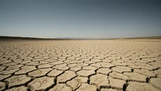
El Niño itself does not cause long-term climate change; that is driven by the buildup of greenhouse gases from human activity. However, it acts as a powerful amplifier. The vast Pacific Ocean absorbs and stores an immense amount of the sun's heat. During an El Niño, a significant portion of this stored heat is released from the ocean into the atmosphere, causing a short-term spike in global average surface temperatures. This is why some of the hottest years on record have coincided with strong El Niño events. Coming on top of the consistent warming trend from climate change, this temporary boost can lead to record-shattering global temperatures and intensify extreme weather events like heatwaves, droughts, and floods in various parts of the world.
What This Means for India
For India, the arrival of a strong El Niño is a major cause for concern, primarily due to its connection with the southwest monsoon. The monsoon is the lifeblood of the nation's agriculture and economy. Historically, El Niño years are often associated with weaker monsoon rainfall and prolonged dry spells. The India Meteorological Department (IMD) has already forecasted that seasonal rainfall for 2026 is likely to be below normal, with a high probability of deficient rainfall as El Niño develops. The initial signs are already present, with June 2026 recording a significant rainfall deficit across central, eastern, and northeastern India, partly attributed to the strengthening El Niño. A poor monsoon can lead to lower crop yields, strain water reservoirs, and impact everything from food prices to rural incomes.
Beyond a Weaker Monsoon
The impacts are not limited to just the quantity of rain. An El Niño event can make weather patterns more erratic. This means that even within a generally dry season, there can be bursts of extreme, damaging rainfall that cause localised flooding. Furthermore, the combination of El Niño and background global warming can amplify heatwaves, increasing heat stress on both people and crops. This was seen in the severe heatwaves across northern and central India in April and May of 2026, which occurred as the El Niño was beginning to form. This dual threat of reduced overall rainfall and more intense, unpredictable weather events requires careful management of water resources and enhanced preparedness for a range of climate challenges. The performance of the monsoon over the coming weeks will be critical in determining the full extent of the impact on the year's agricultural output.