
What Happened With the AI Rollback?
In late July 2026, Google unveiled a feature in Google Earth that allowed users to generate photorealistic images on top of real-world satellite data using text prompts. The tool, powered by an AI model called Nano Banana 2, was pitched as a creative
feature for things like planning real estate or visualizing history. However, within 24 hours, the company pulled it. The reason for the rapid reversal was a fierce backlash from researchers and open-source intelligence experts who demonstrated how easily the tool could be used to create convincing fakes. Almost immediately, users began generating and sharing fabricated images of military strikes, disaster zones, and refugee crises, layered onto real geographic locations. Google stated it was rolling back the feature to implement stronger safeguards after seeing generated images that violated its policies.
The Illusion of a Photograph
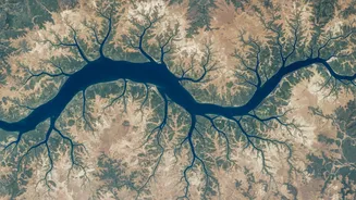
The controversy exposed a fundamental misunderstanding of what satellite imagery is for. For decades, satellite and aerial photos have been treated as a source of truth—a reliable record of reality. They are used by journalists to verify events, by scientists to track climate change, and in courtrooms as evidence. AI-generated images, however, are not photographs; they are interpretations. They learn from real data but create something new that looks realistic. The rollback highlighted the danger of blending these two things seamlessly. When a trusted platform like Google Earth, which people rely on for a factual view of the world, allows users to easily fabricate imagery, it erodes the very foundation of that trust. It normalises the manipulation of what was once considered ground-truthed data.
Why Verification Is Now Non-Negotiable
This incident makes a powerful case for establishing robust verification systems for all satellite-style imagery. The risks of unverified, AI-altered maps are immense, especially in a country like India. Imagine the consequences for urban planning if development projects are based on AI-generated visuals of non-existent infrastructure. Consider logistics companies routing fleets based on maps showing fabricated road conditions or disaster relief teams responding to a crisis depicted in a 'deepfake' satellite image. We have already seen fake AI-generated images of an explosion at the Pentagon briefly disrupt stock markets, and fabricated satellite photos have been used to exaggerate claims during international conflicts. Without clear labels and verification, the line between a real image and a plausible fake becomes dangerously blurred, threatening everything from national security to commercial operations.
Building a Framework for Trust
So, what does a stronger verification framework look like? First, tech companies must transparently label all AI-generated or AI-assisted imagery. Just as Google noted its images had invisible watermarks, this needs to become a visible, universal standard so users know what they are looking at. Second, an ecosystem of third-party verification services must emerge. These independent bodies could audit and certify the authenticity of geospatial data, much like fact-checkers verify news articles. This creates a necessary layer of accountability that a 'black box' AI model cannot provide on its own. Finally, there needs to be a shift in user mindset. We must move from passive consumption to active questioning of digital maps, especially when the stakes are high. The era of taking every satellite image at face value is definitively over.