





A New Watchtower in Orbit
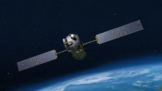
In a significant leap forward for environmental monitoring, three new FireSat satellites were successfully launched into orbit in July 2026. This trio is the first operational wave of a much larger planned constellation of over 50 satellites dedicated
solely to spotting wildfires from their inception. The project is spearheaded by the Earth Fire Alliance (EFA), a non-profit coalition, in a landmark partnership with private tech firms like spacecraft manufacturer Muon Space and Google Research. Unlike existing weather or Earth-observation satellites, which serve multiple purposes, the FireSat system is custom-built for one critical job: finding fires while they are still small enough to be controlled.
Seeing Heat, Not Just Smoke
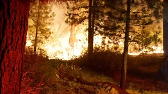
The technological edge of the FireSat constellation lies in its advanced sensors. Each satellite is equipped with a six-channel multispectral infrared payload, allowing it to detect the heat signature of a fire rather than waiting for a visible smoke plume. This is a game-changer. The system is engineered to spot fires as small as five by five metres—roughly the size of a large bonfire—under favourable conditions. By scanning for thermal anomalies, the satellites can identify new ignitions long before they would be visible to the human eye or even some existing satellite systems, which often lack the resolution or revisit frequency to catch small blazes.
From Hours to Minutes
The true revolution of FireSat is its promise of speed. Current satellite systems can take hours, or even a full day, to pass over the same spot twice. In that time, a small spark can escalate into an uncontrollable megafire. While the initial three-satellite constellation will provide revisits at least twice daily for fire-prone regions, the ultimate goal is far more ambitious. Once the full constellation of around 50 satellites is deployed by the end of the decade, it aims to scan every point on Earth approximately every 20 minutes. This drastic reduction in time between detection and alert is critical. The system uses artificial intelligence to compare new images with previous ones, factoring in weather and other heat sources to reduce false alarms before a human analyst confirms the threat and notifies fire agencies, a process that can take just a few minutes.
A Public-Private Alliance Against Fire
The FireSat initiative is a powerful example of a new model for tackling global challenges, blending non-profit leadership with private sector innovation and philanthropic funding. The Earth Fire Alliance leads the coalition, ensuring the data serves the public interest. Muon Space designed and built the highly specialised satellites. Google has provided its AI expertise and significant financial backing through its philanthropic arm, Google.org, which has contributed over $15 million to get the early satellites into orbit. This collaborative structure allows the project to leverage cutting-edge technology for a public safety mission, making the data accessible to fire agencies worldwide that need it most.
The Impact on the Front Lines
For firefighters on the ground, this technology could be transformative. Early detection provides a critical window to dispatch resources and contain a blaze before it endangers lives and property. Receiving an alert before the first 911 call is even made can make all the difference. The system is designed to work in tandem with ground-based AI camera networks, creating a comprehensive detection shield. While FireSat is not a silver bullet—it will supplement, not replace, existing methods like lookout towers and emergency calls—it represents a fundamental shift from reactive to proactive firefighting. The initial operational phase, which began with the recent launch, will serve as a crucial test, proving the system's reliability and demonstrating how much time it can save in real-world scenarios.