







A Flawless Predawn Launch
In the early hours of September 4, the Geosynchronous Satellite Launch Vehicle (GSLV-F17) rocket soared into the sky from the Satish Dhawan Space Centre in Sriharikota. About 18 minutes after a perfect liftoff, the rocket successfully placed the 2,367
kg EOS-05 satellite into its intended orbit. The mission was declared a success by ISRO Chairman V. Narayanan, bringing an end to an eight-month pause in launch activities for the agency. This launch not only deploys a critical national asset but also restores confidence in the GSLV rocket, which has had a mixed history and was once nicknamed the 'naughty boy' for its early failures.
What Makes EOS-05 Different?
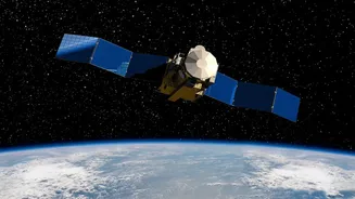
EOS-05 is not just another satellite; it's India's first imaging satellite designed to operate from a geosynchronous orbit, approximately 36,000 kilometres above the Earth. Most Earth observation satellites, like those in the Cartosat and RISAT series, are in Low Earth Orbit (LEO), meaning they circle the planet at a much lower altitude and can only view a specific location when they pass over it. In contrast, a satellite in geosynchronous orbit moves at the same speed as the Earth's rotation. This allows EOS-05 to hover over the Indian subcontinent, providing near-continuous observation of a huge geographical area. This persistent watch is a game-changer for monitoring rapidly developing events.
A Crucial Tool for Disaster Management
The primary benefit of this constant monitoring is a massive boost to disaster management and early warning systems. EOS-05 can capture images of the entire Indian landmass roughly every 30 minutes, and of specific priority areas even more frequently. This capability is invaluable for tracking the real-time development of cyclones, mapping flood-affected areas, monitoring forest fires as they spread, and observing cloudbursts. For a country frequently affected by extreme weather, having an 'eye in the sky' that provides timely and wide-area imagery can help save lives and minimize damage by enabling faster, more informed responses from authorities.
Boosting Agriculture and Environmental Monitoring
Beyond disasters, the data from EOS-05 is set to benefit India's massive agricultural sector. The satellite's sensors can monitor crop health, assess soil moisture, and track changes in vegetation over the seasons. This information helps in forecasting yields, managing water resources efficiently, and promoting sustainable farming practices. Furthermore, the satellite will contribute to environmental monitoring by observing changes in water bodies, forests, and land use patterns. This continuous stream of data is vital for understanding and mitigating the impacts of climate change and environmental degradation across the country.
Enhancing National and Strategic Security
While its civilian applications are extensive, EOS-05 also provides a significant strategic advantage. The ability to maintain a constant watch over the Indian subcontinent and surrounding maritime regions enhances the nation's security apparatus. Earth observation satellites with these capabilities are critical for monitoring borders, tracking movements in areas of interest, and maintaining situational awareness. While ISRO focuses on the satellite's role in national development, officials have acknowledged that it will provide important strategic data for the country. This dual-use capability makes EOS-05 an invaluable asset for both civilian governance and national defence.