








What Exactly Is El Niño?
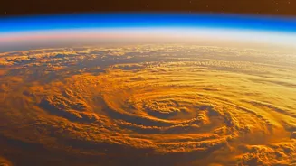
El Niño is a natural climate phenomenon characterized by the unusual warming of the surface waters in the central and eastern tropical Pacific Ocean. Think of it as a large-scale warming event in the ocean that happens every few years. This change in ocean temperature
might seem distant, but it has a powerful domino effect on weather patterns across the globe. It disrupts the normal atmospheric circulation, altering wind and rainfall patterns far and wide, with India’s crucial southwest monsoon being particularly vulnerable to its influence. The opposite of El Niño is La Niña, which involves a cooling of the same ocean region and often has the reverse effect.
How It Disrupts India's Monsoon
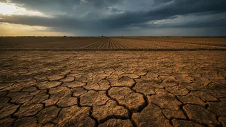
A strong El Niño typically spells trouble for India's monsoon. The warming of the Pacific Ocean alters the Walker Circulation, a giant atmospheric loop that affects winds globally. For India, this often means the development of a high-pressure system over the subcontinent, which suppresses the formation of rain clouds and weakens the moisture-carrying monsoon winds that blow from the sea to the land. This can lead to prolonged dry spells and a significant reduction in overall rainfall during the June to September season. While not every El Niño year results in a drought, there is a strong historical correlation between strong El Niño events and below-normal monsoon rainfall in India.
The Status: A Strong El Niño in 2026
Meteorological agencies have confirmed that El Niño conditions, which began developing in May 2026, are not just present but are strengthening rapidly. As of early August 2026, the phenomenon has intensified to a moderate level and is expected to become a strong event through the end of the year, likely persisting into early 2027. Forecasts from global agencies like the World Meteorological Organization (WMO) and the National Oceanic and Atmospheric Administration (NOAA) indicate an over 80% chance of a 'very strong' El Niño developing between October and December 2026. India’s own agencies are monitoring the situation, with models from the Indian National Centre for Ocean Information Services (INCOIS) also forecasting its persistence until at least February 2027.
The Scale of the Impact on Rainfall
The impact of the strengthening El Niño is already visible in the 2026 monsoon data. While July saw a brief recovery with near-normal rain at an all-India level, the overall season remains deficient. As of early August, the cumulative rainfall deficit for the country stood at 11-12% below the long-period average. The distribution has been highly uneven. The India Meteorological Department (IMD) had forecast a below-normal monsoon for 2026, and its predictions for below-average rainfall in August appear to be materializing, driven by the suppressing effect of El Niño. Some reports note a positive Indian Ocean Dipole (IOD) could partially counteract El Niño's drying effect, but the dominant signal remains one of suppression.
Ripple Effects on Agriculture and the Economy
The rainfall deficit has directly impacted the sowing of Kharif (monsoon) crops. As of early August, the total area sown was still trailing last year's figures, with a shortfall of just under 2%. The sowing of paddy (rice), a water-intensive and critical food crop, was down by over 4% compared to the previous year. This delay and deficit in sowing raise concerns about agricultural output, rural incomes, and food inflation later in the year. Lower rainfall also affects water levels in major reservoirs, which are crucial for winter crops and drinking water supply. While sowing has picked up in some areas, the performance of the monsoon in the latter half of August and September will be critical for determining final crop yields.