






The Deluge on the Ground
In late July and early August 2026, Kerala was caught off guard by sudden, intense downpours. After a prolonged dry spell that saw a 34% monsoon deficit until July 31, the situation reversed dramatically. Over the next few days, the state received rainfall
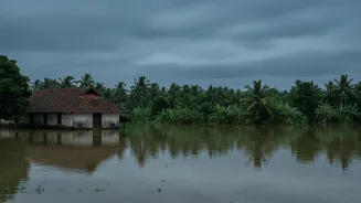
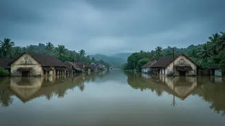
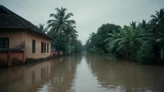
more than three times the normal amount for the period. Rivers like the Pamba, Manimala, and Meenachil overflowed, inundating towns, while flash floods and landslides caused widespread destruction, particularly in the hilly regions of Idukki, Kottayam, and Pathanamthitta. The human cost was tragic, with over two dozen confirmed fatalities and thousands displaced into relief camps as homes were destroyed and transport routes cut off. For residents, it was a harrowing repeat of past traumas, as communities once again found themselves grappling with a level of devastation that seemed to appear from nowhere.
What the Forecasts Said
The India Meteorological Department (IMD) had issued warnings, but they seemed out of sync with the storm's eventual ferocity. On the evening of July 31, for instance, an orange alert for heavy rainfall was in place for several districts. However, within hours, conditions escalated dramatically, far exceeding the alert's parameters. By midnight, some areas had received nearly 200 mm of rain, with Automatic Weather Stations recording even higher totals, like 248 mm in Laha, Pathanamthitta. This wasn't just a slight miss; in some cases, a red alert predicting over 204 mm of rain was followed by actual rainfall of less than 60 mm, while in other cases, an orange alert was followed by a cloudburst-like deluge. This discrepancy fueled public criticism and left state authorities defending their actions, stating they can only act on the information provided by the IMD.
The Science of a 'Missed' Forecast
So why is it so hard to get it right in Kerala? Experts point to a perfect storm of factors. Firstly, Kerala's unique geography, with the Western Ghats rising sharply from the coast, creates complex microclimates. Moisture-laden winds from the Arabian Sea are pushed upwards by the mountains, leading to highly localized, intense rainfall events that are notoriously difficult for weather models to pinpoint with accuracy. Secondly, the character of the monsoon itself is changing. Instead of steady, prolonged rain, Kerala is increasingly seeing short-duration, high-intensity events, often called mesoscale mini cloudbursts. These systems develop rapidly over small areas, making it a challenge to predict their exact location and intensity, even with modern technology. Scientists acknowledge that while they could see conditions conducive to cloud formation, forecasting the sudden, rapid intensification remains a significant limitation.
Beyond the Weather Models
The crisis, however, isn't just about meteorology. Decades of environmental changes have made Kerala more vulnerable. Widespread deforestation, quarrying on fragile slopes, and the blocking of natural drainage channels mean the landscape can no longer absorb rainwater as it once did. Instead of infiltrating the soil, water now races downhill, turning heavy rain into flash floods and triggering landslides with alarming regularity. Geologists warn that nearly 10,000 square kilometres of the state are landslide-prone. Therefore, the disaster is a result of a changing climate colliding with an ecologically weakened landscape. Even with a perfect forecast, the underlying vulnerability remains a critical issue that needs addressing through better land-use planning and ecological restoration.