




The Challenge of Finding Your Way in Space
For decades, navigating in deep space has been a complex and Earth-bound process. Spacecraft have relied on a constant dialogue with mission control, using massive antennas from networks like the Deep Space Network to send and receive signals. By meticulously
measuring the time it takes for these radio waves to travel back and forth, engineers can calculate a spacecraft's position and speed. While incredibly effective, this method is resource-intensive and creates a dependency on a constant line of communication with Earth. For future ambitions, like establishing a sustained human presence on the Moon under the Artemis program, this reliance becomes a bottleneck, limiting the number of simultaneous missions and the ability of astronauts and rovers to explore freely.
A 'Lunar GPS' Enters the Scene
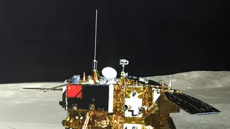
To solve this, NASA has been testing a revolutionary concept: using Earth's own Global Navigation Satellite System (GNSS), which includes the familiar GPS, to navigate on and around the Moon. A key test of this idea was the Lunar GNSS Receiver Experiment (LuGRE), a joint payload between NASA and the Italian Space Agency. This device was designed to do something many thought impossible: detect the faint whispers of GNSS signals that travel nearly 400,000 kilometres past Earth to reach the Moon. Flown aboard Firefly Aerospace's Blue Ghost lander as part of NASA's Commercial Lunar Payload Services (CLPS) initiative, LuGRE's objective was to prove that this 'lunar GPS' could work in practice.
How It Works: Catching Faint Signals
GPS and other GNSS satellites are designed to blanket the Earth with signals for navigation on the ground, in the air, and in near-Earth orbit. Their antennas primarily point downward. However, a significant amount of signal 'spills' past the edges of the Earth from the opposite side of the planet. These are the faint, stray signals that LuGRE was built to catch. The experiment used a highly sensitive, specialized receiver and a high-gain antenna to lock onto signals from both the U.S. GPS and Europe's Galileo constellations. In early 2025, the experiment proved a stunning success. LuGRE not only tracked these signals in transit and in lunar orbit, but it also achieved the first-ever GNSS-based navigation fix on the surface of the Moon, effectively proving that a terrestrial navigation system could be used for lunar positioning.
A Leap Towards Autonomy
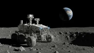
The success of LuGRE and similar payloads like the NavCube3-mini heralds a major shift towards more autonomous space travel. With the ability to calculate their own position in real-time, future lunar landers, rovers, and even astronauts can operate with unprecedented independence. This reduces the constant need for oversight from mission control, freeing up valuable Deep Space Network resources for other scientific missions. It allows for faster, more dynamic decision-making during critical moments like orbital manoeuvres or landing sequences. For surface exploration, it means astronauts and robotic rovers could navigate the vast, unmapped lunar landscape with the same ease and precision as we navigate city streets on Earth.
Building the Future of Lunar Exploration
This technology is a critical building block for NASA's Artemis program, which aims to establish a long-term human presence on the Moon. By enabling reliable, autonomous navigation, NASA and its commercial partners can build a more robust and scalable lunar infrastructure. These developments are part of a larger architecture called LunaNet, envisioned as an interoperable network providing communications and navigation services for all lunar missions. This will support a bustling ecosystem of orbiters, landers, and scientific outposts. The ability for missions to navigate independently is foundational to making routine trips to the Moon a reality, paving the way for the complex operations that will eventually take humans to Mars.