





A New, Unblinking Eye on the Poles
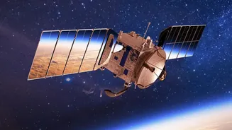
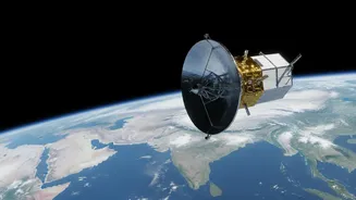
NASA recently released striking animations showcasing two full years of temperature data from its PREFIRE mission, which stands for Polar Radiant Energy in the Far-InfraRed Experiment. Since starting their observations in July 2024, two shoebox-sized
satellites, called CubeSats, have been continuously measuring a type of energy that has been notoriously difficult to track: far-infrared radiation. This is essentially heat escaping from the top and bottom of the world. The mission has now captured two complete seasonal cycles, providing an uninterrupted view of how surface temperatures pulse between the brutal cold of polar winter and the relative mildness of summer. This isn't just another temperature map; it's the first systematic, multi-year measurement of a critical component of the Earth's energy budget, filling a significant gap in our understanding.
Decoding the Poles' Energy Puzzle
The PREFIRE data helps scientists understand how much heat the Arctic and Antarctic radiate into space. This process is fundamental to keeping the planet balanced. Heat absorbed in the sunny tropics is transported toward the poles by ocean and atmospheric currents. The icy regions then act like radiators, releasing that energy. However, things like water vapor and clouds can trap this outgoing radiation, acting like a blanket and contributing to warming—a key part of the greenhouse effect. Far-infrared radiation accounts for a surprisingly large share of this energy exchange, nearly 60 percent of what Earth loses to space. By directly measuring it for the first time over a prolonged period, scientists can now refine the climate models used to predict future changes, making them more accurate.
Two Poles, Two Different Stories
The new animations clearly illustrate that the Arctic and Antarctic are not behaving identically. While their seasons are opposite, their geographies create very different responses to warming. During its summer, large areas of the Arctic thaw, exposing darker land and ocean surfaces which absorb more sunlight, a phenomenon known as reduced albedo that accelerates warming. In contrast, much of Antarctica, a vast, high-altitude continent, remains below freezing even in its summer months. Understanding these distinct seasonal swings is vital. The stability of polar ice sheets, the flow of rivers, and the viability of Arctic shipping routes are all dependent on how heat moves through these complex systems.
Why Polar Problems Go Global
What happens in the icy regions doesn't stay there. The health of polar ice has a direct impact on global sea levels and weather patterns. As land-based ice sheets in Greenland and Antarctica melt, they pour fresh water into the ocean, causing sea levels to rise worldwide. Furthermore, a rapidly warming Arctic can disrupt major atmospheric currents like the jet stream, leading to more extreme and unpredictable weather events—including heat waves, cold snaps, and intense storms—in North America, Europe, and Asia. The data from PREFIRE provides a clearer picture of the mechanics behind this warming, offering critical information that helps link polar changes to the weather you might experience in your own backyard.