






A Familiar Crisis, A New Character
For generations, Keralites have lived by the rhythm of the monsoon. Yet, the floods that have inundated the state in recent years feel different. While the sight of swollen rivers and waterlogged streets is familiar, the cause is shifting from prolonged
deluges to sudden, violent downpours. Recent analysis of rainfall data shows a worrying trend: the total number of rainy days is decreasing, but the frequency of extreme, short-duration rain events is on the rise. This means the state is receiving massive amounts of rain, sometimes several hundred millimeters, in just a few hours. This change presents a fundamentally new challenge, turning predictable seasonal flooding into a series of unpredictable, fast-moving disasters.
The Science of a Cloudburst
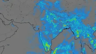
What exactly is this 'short, intense rainfall'? Meteorologists often refer to these as mesoscale convective systems—essentially, highly localized and powerful storm cells. Think of it less like a traditional widespread monsoon and more like a celestial bucket being emptied over a very small area. These events are often triggered when warm, moisture-laden winds from the Arabian Sea are forced upward by the steep slopes of the Western Ghats. This rapid ascent causes moisture to condense quickly, forming towering clouds that unleash torrential rain in a short span. Studies show that climate change is exacerbating this phenomenon, making the atmosphere warmer and capable of holding more moisture, which in turn makes these downpours about 10-15% more intense than they would be otherwise.
The Forecasting Conundrum
Predicting these events is a monumental challenge. Standard weather models are excellent at forecasting large-scale weather systems, like cyclones or the overall path of the monsoon, days in advance. However, they struggle to capture these small, rapidly developing storm cells. The complex topography of the Western Ghats, with its deep valleys and steep mountains, creates microclimates that can significantly alter weather in a very small area, further complicating predictions. By the time a Doppler radar picks up on a rapidly forming system, it might only be an hour or two away from unleashing a deluge, leaving disaster management authorities with a critically short window to issue warnings and evacuate vulnerable populations, especially in hilly, landslide-prone regions.
From Ground Zero to Policy Shift
The impact on the ground is devastating. Intense rain on saturated soil is a primary trigger for the deadly landslides seen in districts like Idukki and Wayanad. Flash floods can inundate towns and villages in minutes, far faster than the gradual riverine floods of the past. In response, Kerala's disaster management strategy is undergoing a necessary evolution. The state government is now investing in a denser network of automatic weather stations and is planning to roll out an AI-powered forecasting system to provide hyper-local alerts. The goal is to move from broad, district-level warnings to granular, village-level predictions that can give people precious extra time to react. This involves integrating the strengths of various models and expert knowledge to build a more resilient early-warning infrastructure.