





India’s Unblinking Eye in the Sky
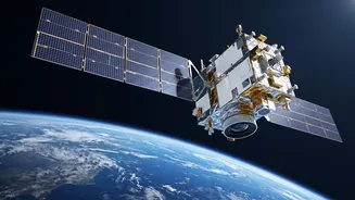
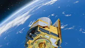
What makes EOS-05 a game-changer is its orbit. Unlike many Earth observation satellites that circle the planet in lower orbits and pass over a location only periodically, EOS-05 is stationed in a geosynchronous orbit approximately 36,000 kilometres high.
This unique position allows it to match the Earth's rotation, effectively hovering over the Indian subcontinent. The result is the ability to provide continuous, near real-time monitoring of the entire country. Dubbed an "eye in the sky," it can image the entire Indian landmass every half-hour, and focus on specific areas of interest in as little as five minutes. This persistence is its greatest strength, turning satellite imaging from a series of snapshots into a constant stream of live information.
A Shield Against Natural Disasters
For a country prone to natural calamities, this constant watch is a powerful new tool for disaster management. EOS-05 is designed to track rapidly evolving events like cyclones, floods, and forest fires. When a cyclone forms, the satellite can provide continuous updates on its intensity and path, giving authorities crucial time to issue warnings and evacuate vulnerable populations. In the event of widespread flooding, its imagery can help create near real-time maps of inundated areas, identifying which villages are cut off and which roads remain accessible for rescue teams. This rapid situational awareness, available regardless of weather or time of day, transforms disaster response from a reactive effort to a proactive, data-driven operation, ultimately saving lives and property.
Revolutionising the Agricultural Landscape
Beyond emergencies, EOS-05 promises to have a profound impact on India's agricultural backbone. The satellite's advanced multi-spectral and hyperspectral imagers can monitor crop health, assess soil moisture levels, and track land use changes across vast farmlands. This data flows into national programs like FASAL (Forecasting Agricultural output using Space, Agrometeorology and Land-based Observations) and Krishi-DSS, which provide vital information to farmers and policymakers. Farmers receive advisories on everything from optimal irrigation to early warnings of pest attacks, empowering them to increase yields and reduce costs. On a national level, this technology enables more accurate crop production forecasts, which are essential for managing food security, pricing, and distribution.
Strengthening National and Strategic Awareness
The applications of EOS-05 extend into the strategic domain as well. The ability to maintain a constant vigil over India’s land and maritime domains is a significant asset for national security. While lower-orbit satellites provide high-resolution images, their predictable passes can be tracked. EOS-05’s persistent stare from a geosynchronous orbit provides a different, complementary layer of surveillance. This enhances situational awareness across borders and coastal areas, allowing for continuous monitoring of strategic assets and regional developments. ISRO has described the satellite as having 'strategic' value, a term that encompasses everything from security to crucial weather and resource monitoring that underpins national stability.