




A Different Kind of Downpour
Forecasting models are generally adept at predicting large-scale monsoon systems moving across the state over days. However, recent events in Kerala have been characterized by something different: intense, highly localized downpours, sometimes called
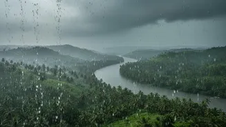
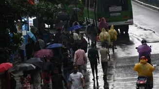
'mini-cloudbursts' or 'mesoscale convective systems'. These are not the widespread, persistent rains of a typical monsoon day. Instead, they involve deep convective clouds that develop rapidly, dumping enormous amounts of rain (over 100 mm in a few hours) on a very small area. This sudden escalation from a standard 'heavy rain' forecast to an 'extremely heavy rain' reality can happen within hours, catching forecasters and residents off guard.
The Western Ghats Effect
Kerala's unique geography is a major factor. The state is a narrow strip of land wedged between the Arabian Sea and the high-altitude Western Ghats. This terrain plays a crucial role in weather formation. Moist winds from the sea are pushed upwards by the mountain range in a process called orographic lifting. This ascent forces the air to cool and condense, forming clouds and causing rain. While this process is normal, the steepness of the Ghats can create microclimates and rapidly intensify weather systems in unpredictable ways, leading to extremely heavy rainfall in one valley while a neighboring area remains relatively dry.
Nowcasting vs. Forecasting
There's a critical difference between forecasting and nowcasting. Forecasting predicts weather conditions days in advance for a wider region, like a district. Nowcasting aims to predict weather in the very short term, typically 0-3 hours, for a specific locality. While the India Meteorological Department (IMD) can issue a broad alert for heavy rain, pinpointing the exact location and intensity of a mini-cloudburst hours before it happens is a nowcasting challenge of a different magnitude. These events develop and dissipate so quickly that by the time they are fully visible on monitoring systems, they are already happening.
The Limits of Technology
Modern weather prediction relies on Numerical Weather Prediction (NWP) models and a network of Doppler radars. However, these tools have limitations. Weather models divide the atmosphere into a grid, and their resolution might not be fine enough to 'see' or resolve the small-scale atmospheric processes that give birth to a mini-cloudburst. Doppler radars are essential for nowcasting, but their effectiveness can be hampered by the terrain itself; mountains can block radar beams, creating blind spots. While Kerala has been expanding its radar network, ensuring complete coverage over its complex topography is an ongoing process.
A Changing Climate
Underlying these challenges is the reality of climate change. A warmer atmosphere and a warmer Arabian Sea mean more moisture is available to the monsoon system. This doesn't necessarily mean more rainy days, but it increases the likelihood of rainfall being concentrated into short, intense, and destructive bursts. Studies show a rising trend in the frequency of extreme rainfall events in Kerala, particularly in the northern districts and along the Western Ghats. This shift means that historical data, which is crucial for forecasting, is becoming a less reliable guide to the future, forcing scientists to constantly adapt.