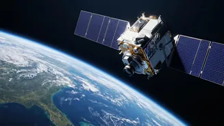









A New Guardian in Geosynchronous Orbit
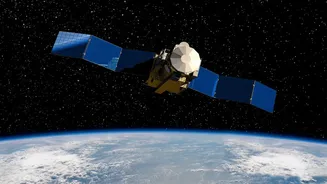
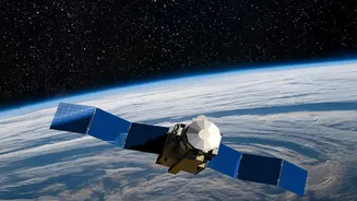
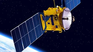
The recent launch of the EOS-05 satellite is a landmark achievement for the Indian Space Research Organisation (ISRO). Placed in a high geosynchronous orbit nearly 36,000 kilometres above Earth, EOS-05 is not just another satellite; it's a strategic asset.
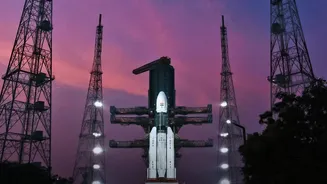
Unlike satellites in Low Earth Orbit (LEO) that circle the planet multiple times a day, a geosynchronous satellite remains fixed over a specific region. This allows EOS-05 to provide near-continuous monitoring of the entire Indian subcontinent. The mission's success, aboard a GSLV rocket, is a significant boost for India's space program, especially following the setback with the similar EOS-03 (GISAT-1) mission in 2021, which failed to reach orbit due to a technical anomaly. This launch demonstrates ISRO's resilience and its mastery over complex launch technologies.
Revolutionising Disaster Management
One of the most critical applications of the EOS-05 and the broader EOS program is in disaster management. With the ability to capture images of a specific region every five minutes, EOS-05 can track the rapid development of natural disasters like cyclones, floods, and forest fires in near real-time. This capability is a game-changer for emergency response. Timely warnings can help authorities evacuate populations, and continuous monitoring allows for better coordination of relief efforts. Satellites like EOS-01, with its all-weather synthetic aperture radar (SAR), can see through clouds and darkness, providing invaluable data during monsoons when it's needed most. This network of satellites acts as a national alert system, saving lives and property by providing crucial lead time before disaster strikes.
A Boost for Agriculture and the Economy
Beyond saving lives, India's Earth Observation satellites are a powerful engine for economic growth, particularly in the agricultural sector. Satellites like EOS-04 and EOS-06 (Oceansat-3) provide a wealth of data on soil moisture, crop health, and vegetation. This information is channelled into programs like Krishi-DSS, a decision support system that gives farmers real-time, data-driven advice on irrigation, fertiliser use, and pest control. By optimising resource use, farmers can increase yields and reduce costs. Furthermore, these satellites help in forecasting agricultural output, enabling better policy planning and ensuring food security. The ocean-monitoring capabilities of satellites like EOS-06 also support the fishing industry by identifying potential fishing zones.
Enhancing National Security
The strategic implications of a satellite like EOS-05 are immense. Its ability to maintain a constant watch over the Indian subcontinent provides a significant advantage for national security. The satellite's high-resolution cameras can monitor borders and maritime zones, offering crucial intelligence for defence purposes. While many ISRO satellites have dual-use capabilities, the development of dedicated geo-imaging platforms represents a major step up in India's strategic surveillance capacity. The radar imaging capabilities of satellites in the EOS series, which can operate day and night and in all weather conditions, ensure that the nation's strategic assets and borders are under a watchful eye, providing a layer of security that is both persistent and powerful.