




An Unblinking Eye on Geopolitical Fault Lines
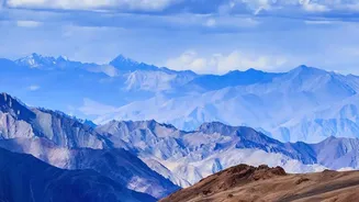
In the high-stakes theatre of geopolitics, the Himalayan frontier, particularly the Line of Actual Control (LAC) between India and China, is a critical flashpoint. Here, verifiable information is paramount. Satellite imagery provides undeniable evidence
of military activities. Analysts can track the construction of new roads, airbases, and military camps, offering a clear picture of strategic build-ups that ground patrols could never fully capture. During tense standoffs, satellite data has been used to verify troop movements and the dismantling of temporary structures as part of de-escalation agreements. This objective evidence is crucial for both military planning and diplomatic negotiations, allowing nations to counter disinformation and base their actions on factual ground reality, as seen from hundreds of kilometres above.
The All-Weather Advantage of Radar
The Himalayas are notorious for their harsh and unpredictable weather, with persistent cloud cover often rendering standard optical satellites ineffective. This is where Synthetic Aperture Radar (SAR) technology is a game-changer. SAR satellites can penetrate clouds, fog, and even dry snow, providing a consistent and reliable stream of data regardless of weather conditions or time of day. This capability is vital for everything from tracking troop movements during monsoon season to monitoring ground deformation that could signal an impending landslide. The recently launched NASA-ISRO Synthetic Aperture Radar (NISAR) mission, for instance, uses L-band and S-band radar to monitor changes on the Earth's surface, including the ability to detect glacial lakes hidden under snow. This all-weather, 24/7 capability makes SAR an indispensable tool for comprehensive surveillance in the region.
Monitoring Earth's 'Third Pole'
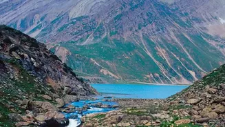
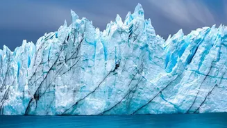
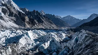
Home to the largest ice mass outside the polar regions, the Himalayas are often called Earth's 'Third Pole'. These glaciers are a vital source of water for nearly a billion people, but they are melting at an accelerated rate due to climate change. Satellite technology is fundamental to tracking this alarming trend. By comparing imagery over decades, scientists can measure glacier retreat, ice mass loss, and changes in snow cover with remarkable precision. This data is essential for understanding the long-term impacts on water resources. Furthermore, as glaciers melt, they form new and expanding glacial lakes, often dammed by unstable piles of rock and ice. Satellites are crucial for inventorying these lakes and identifying which ones pose a risk of a Glacial Lake Outburst Flood (GLOF), a catastrophic event that can devastate downstream communities.
A Lifeline During Natural Disasters
The Himalayan region is a hotbed of natural hazards, including earthquakes, landslides, avalanches, and flash floods. When disaster strikes, remote areas are often completely cut off, making it impossible to assess the damage or coordinate rescue efforts. Satellite imagery becomes a critical first-response tool. It provides a rapid overview of the affected area, helping authorities identify the extent of flooding, map landslides, and locate damaged infrastructure like roads and bridges. This information is vital for directing rescue teams and delivering aid to those in need. Early warning systems are also increasingly reliant on satellite data to monitor precursors to disaster, such as the stability of a swelling glacial lake or ground movement on a vulnerable slope, providing precious time for evacuation.