






A Resounding Success in Space
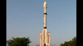
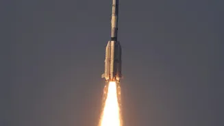
On September 4, 2026, the Indian Space Research Organisation (ISRO) achieved a significant milestone, successfully launching the EOS-05 satellite aboard its powerful GSLV-F17 rocket. Lifting off from the Satish Dhawan Space Centre in Sriharikota, the launch was
not just another mission; it was a moment of triumph. This success provided a major boost to the GSLV programme, especially after the unfortunate failure of the EOS-03 mission in 2021 and other recent launch setbacks. The flawless injection of the 2,367-kg satellite into its intended orbit marked a powerful return to form for the space agency, reaffirming its capabilities in handling complex and heavy payloads for crucial national missions.
The Geosynchronous Advantage
The single most important feature of the EOS-05 mission is its destination: a geosynchronous orbit approximately 36,000 kilometres above the Earth. This makes EOS-05 India's first dedicated imaging satellite to operate from such a high altitude. Unlike most Earth observation satellites, which circle the planet in Low Earth Orbit (LEO) at a few hundred kilometres and pass over a location only periodically, EOS-05's orbit is synchronized with the Earth's rotation. This allows it to remain positioned over the Indian subcontinent, providing a constant, near-continuous watch over a vast region. Instead of getting fleeting glimpses, ISRO can now maintain a persistent stare, which is a fundamental leap in India's observation capabilities.
A Guardian for National Safety
This persistent watch has profound implications for civilian life and safety. One of the primary applications is in disaster management. With the ability to provide near real-time imagery, authorities can monitor the development of cyclones, track the spread of floods, and observe the progression of forest fires with unprecedented frequency. This capability is critical for issuing timely warnings, planning evacuations, and coordinating relief efforts more effectively. Beyond emergencies, the satellite will also be an invaluable tool for monitoring agriculture, assessing crop health, tracking environmental changes like snow cover and glacier melt, and managing water resources, providing vital data for national planning.
Strengthening India’s Strategic Edge
Alongside its civilian benefits, EOS-05 has been described as a 'strategic satellite' for good reason. Its continuous surveillance capability significantly enhances India's national security apparatus. The ability to maintain a constant watch over border areas and surrounding regions of interest provides a crucial advantage for security forces, allowing for better monitoring of developments and quicker responses to potential challenges. While most LEO satellites provide high-resolution snapshots, EOS-05 offers the bigger picture, observing patterns and changes over time. This dual-use nature—serving both civilian and strategic needs—makes it one of the most versatile and valuable assets in India's space infrastructure.
The Technology Behind the Vision
To achieve its mission, EOS-05 is equipped with state-of-the-art imaging instruments. It carries multispectral and hyperspectral cameras, allowing it to see the Earth in various wavelengths of light, far beyond what the human eye can perceive. This advanced technology enables it to gather detailed information for its diverse applications. The satellite can image the entire Indian landmass every 30 minutes and focus on a selected region of interest to provide an image every five minutes, all at a respectable spatial resolution of 42 metres. This combination of constant vigilance and rapid revisit capability is what truly defines the power of this new 'eye in the sky' and makes the EOS-05 mission a landmark achievement for India.