






A Deluge in 'God's Own Country'
In the first week of August 2026, Kerala witnessed an intense spell of monsoon rainfall, triggering widespread flooding, landslides, and significant disruption. The state received 205.8 mm of rain between August 1 and 4 alone, a staggering 181% excess
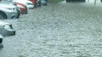
compared to the normal of 73.2 mm for the period. This deluge led to tragic consequences, with the death toll rising to 26 and over 18,000 people forced to move into more than 400 relief camps across the state. The India Meteorological Department (IMD) issued a red alert—its highest warning for extremely heavy rainfall—for eight of the state's fourteen districts on August 4, including Pathanamthitta, Kottayam, and Idukki. Rivers like the Periyar, Pamba, and Meenachil swelled, inundating low-lying areas and turning roads into waterways, prompting extensive rescue operations.
India's Forecasting Arsenal
At the heart of India's disaster preparedness strategy is its short-range weather forecasting capability, led by the IMD. These forecasts, typically covering a window of up to 72 hours, are crucial for issuing timely warnings. The system relies on advanced Numerical Weather Prediction (NWP) models, such as the National Centre for Medium Range Weather Forecasting's (NCMRWF) Unified Model, known as NCUM. These high-resolution models process vast amounts of atmospheric data to predict the location, intensity, and timing of rainfall. An accurate short-range forecast is the first, most critical step in the disaster response chain, allowing authorities to pre-position resources, alert vulnerable populations, and evacuate areas at high risk of floods or landslides.
A Mixed Verdict on the Ground
The performance of these forecasting systems during the recent Kerala emergency has been a mixed bag. On one hand, the IMD successfully issued red alerts for multiple districts, correctly anticipating a period of extremely heavy rainfall. This gave state authorities a basis for action. However, the system struggled with the precise intensity and timing of sudden, highly localised downpours. For instance, on the night of July 31, an orange alert was upgraded to a red alert situation within hours as rainfall intensified dramatically and unexpectedly, exceeding 200 mm in places like Peerumedu. While models can predict a broad pattern of heavy rain, accurately forecasting these 'cloudburst-like' events remains a significant challenge, leading to situations where the on-ground reality is more severe than the alert level initially suggested.
The Last-Mile Challenge
Even a perfect forecast is only effective if the warning reaches people in time and they can act on it. This is the persistent challenge of 'last-mile connectivity'. While India has made strides with initiatives like the Common Alerting Protocol (CAP) to send geo-targeted alerts via SMS and mobile apps, gaps remain. Experts point out that disaster response needs to compensate for decades of ecological degradation and unsustainable land use, which amplify the effects of heavy rain. The recurring nature of these floods in Kerala, despite improvements in early warning systems since the devastating 2018 floods, shows that the problem is not just about prediction. It is also about translating those warnings into effective on-ground action, managing dam levels, and addressing the underlying environmental vulnerabilities that turn heavy rain into a full-blown catastrophe.
Lessons for the Next Monsoon
The 2026 Kerala floods serve as another stark reminder of the complexities of disaster management in an era of climate change. While India's forecasting models like NCUM have improved, they still show limitations in predicting the exact intensity of extreme rainfall events, sometimes underpredicting the severity. The path forward requires a two-pronged approach. First, continued investment in improving high-resolution weather models and incorporating more real-time data to better predict localised extreme events is essential. Second, and just as critically, strengthening the entire chain of communication and response is paramount. This means enhancing last-mile alert systems, improving local disaster management plans, and critically re-examining land use and development patterns in ecologically fragile zones to build long-term resilience.