






An Unblinking Eye in the Sky
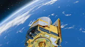
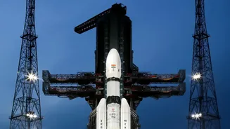
Launched in early September 2026, EOS-05 is not just another satellite; it is ISRO's first dedicated imaging satellite placed in a geosynchronous orbit. Most Earth observation satellites, like those in the Cartosat or RISAT series, operate in Low Earth Orbit
(LEO), circling the planet from a few hundred kilometres up. They capture incredibly detailed images but are constantly on the move, meaning they pass over the same spot only periodically. EOS-05 is different. Positioned approximately 36,000 kilometres above the Earth, it orbits at the same speed as the planet's rotation. This allows it to remain focused on the Indian subcontinent, providing near-continuous observation of a vast geographical area. This constant gaze is its superpower, enabling it to do what LEO satellites cannot: watch events unfold in near real-time.
A Game-Changer for Disaster Management
India is a country frequently visited by natural calamities, from cyclones and floods to forest fires and landslides. During these rapidly evolving events, timely information is the most critical resource. This is where EOS-05 proves its immense worth. The satellite can image a specific area of interest as frequently as every five minutes and the entire Indian landmass every half hour. For disaster management agencies, this is revolutionary. Instead of waiting for a satellite to pass over a flood-affected region, authorities can get a steady stream of images, helping them understand the extent of inundation, identify stranded populations, and plan rescue and relief efforts more effectively. This capability transforms disaster response from a reactive exercise to a proactive, data-driven operation.
Beyond Emergencies: Securing Borders and Farms
The utility of EOS-05 extends far beyond natural disasters. Its persistent monitoring capabilities are a significant asset for national security. The ability to keep a constant watch over border regions and maritime zones provides a strategic advantage, complementing other surveillance assets to offer a more complete picture of any developments. Furthermore, the satellite is a powerful tool for the agricultural sector. Its multispectral imagers can monitor crop health, assess soil moisture, and track vegetation changes over the seasons. This data is invaluable for agricultural planning, drought assessment, and managing the nation's vital natural resources, ensuring food security and sustainable land use.
A Crucial Piece of a Larger Puzzle
In an era of rapid technological advancement, it's easy to focus only on the newest, highest-resolution assets. However, the strength of a national space program lies in the diversity and complementarity of its fleet. EOS-05 doesn't replace the high-resolution LEO satellites; it works in concert with them. While lower-orbit satellites provide granular detail, EOS-05 provides the big picture and the high-frequency updates that are essential for monitoring large-scale, dynamic events. It fills a critical gap, providing the wide-area, persistent surveillance that was previously missing. This successful mission, which followed an earlier failure in 2021, also underscores ISRO's resilience and its commitment to building a robust, multi-layered Earth observation architecture for the nation.