





A Fire That Makes Its Own Weather
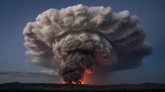
In what is being described as a first for the country, a devastating wildfire in the Gironde region of southwest France has generated a pyrocumulonimbus cloud, or pyroCb. This isn't just a plume of smoke; it is a full-fledged thunderstorm born from the immense
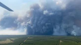
energy of the fire on the ground. The blaze, which erupted near Saumos on July 22, has scorched over 420 square kilometres and forced the evacuation of 220,000 people. But the formation of a fire-generated storm marks a significant and dangerous escalation, turning the fire into a self-perpetuating weather system that no longer just follows the wind but creates its own.
The Science of a Fire Cloud
So, how does a fire create a thunderstorm? The process begins when a massive, intense wildfire releases a tremendous column of superheated air, smoke, and moisture. This column acts like a powerful updraft, rocketing high into the atmosphere. As it ascends into cooler, lower-pressure altitudes, the air expands and cools, causing the moisture within it to condense around ash particles. This forms a towering, smoky cumulus cloud. If the fire is powerful enough and atmospheric conditions are just right—typically with very hot, dry air near the ground and cooler, moister air above—this updraft continues, pushing the cloud to heights of 10 to 15 kilometres, turning it into a pyrocumulonimbus, a genuine thunderhead.
A New Kind of Danger
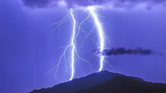
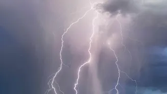
For firefighters, a pyroCb represents a nightmare scenario, multiplying the dangers they already face. These fire storms generate violent and erratic winds, including powerful downdrafts that can hit the ground and spread the fire in unpredictable directions at high speed. This can quickly overrun crews and cut off escape routes. Furthermore, these clouds produce lightning. Unlike a regular storm, the rain from a pyroCb is often light and may evaporate before reaching the ground. This results in 'dry lightning' that can strike kilometres away from the main fire, igniting new blazes in parched forests and complicating containment efforts exponentially.
A Glimpse into a Fierier Future
While pyrocumulonimbus clouds have been documented in the massive fire seasons of Australia and North America, their appearance in France is a startling development. Experts note that Europe is warming at roughly twice the global average, leading to more frequent and severe heatwaves and droughts that turn forests into tinderboxes. These are the exact conditions that allow extreme fires to flourish and, in turn, create their own weather. The fire cloud over Gironde is not just a freak event; it's a stark confirmation of how firefighting is changing on a hotter planet. It serves as a dangerous symptom of a world where fires are becoming so extreme they can bend the atmosphere to their will.