

More Than Just Rain
Recent disasters across the Himalayas have exposed a dangerous gap in our understanding of mountain hazards. While weather models can predict rainfall with increasing accuracy, they are often blind to the subsequent, more lethal threats. Events like the 2021
Chamoli disaster were not caused by a simple cloudburst. Instead, they are what experts call cascading hazards: a chain reaction where one event triggers another. An avalanche of rock and ice can crash into a river, transforming into a debris flow that devastates everything downstream, a danger that weather radar cannot see.
When Glaciers Unleash Chaos
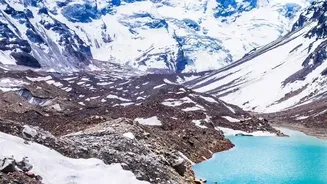
One of the most terrifying threats is the Glacial Lake Outburst Flood (GLOF). As climate change warms the high altitudes, glaciers are retreating and leaving behind massive lakes, often held in place only by unstable dams of loose rock and sediment called moraines. The 2023 flood in Sikkim was a stark example. A landslide into South Lhonak Lake caused it to breach its moraine dam, releasing a torrent of water that destroyed bridges, villages, and the Teesta-III hydropower dam. This wasn't a rain-induced flood; it was the catastrophic failure of a natural dam, an event that standard weather forecasts cannot predict. These glacial lakes are ticking time bombs, and there are thousands of them across the Himalayas.
The Unstable Slopes
Another hidden danger is the landslide dam. Heavy rains can saturate unstable slopes, causing massive landslides that block river channels, creating large, temporary lakes. The danger multiplies when this natural dam inevitably fails, releasing a sudden, powerful flash flood downstream. This sequence of events—a landslide followed by a dam breach—is a geological process, not a meteorological one. The 2021 Chamoli disaster was caused by a massive rock and ice avalanche that rapidly transformed into a debris flow. These incidents highlight how the very ground beneath is a source of unpredictable danger, exacerbated by unregulated construction that further destabilises fragile slopes.
Why Weather Tech Falls Short
Current early warning systems in India are heavily reliant on weather forecasting, including rainfall predictions from the India Meteorological Department and flood advisories from the Central Water Commission. While vital, these systems are not designed to monitor the specific geological risks of the high Himalayas. They cannot 'see' the stability of a glacial moraine, detect the seismic signature of an avalanche in real-time, or predict when a waterlogged slope will finally give way. Past tragedies have repeatedly shown a disconnect where warnings were issued but failed to communicate the true, on-the-ground impact, leaving communities unprepared.
A Blueprint for Survival
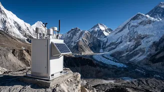
Moving beyond weather forecasts requires building integrated, multi-hazard warning systems. This means deploying ground-based sensors to monitor water levels in high-risk glacial lakes, using satellite radar to detect slow-moving landslides, and installing automated sirens that can trigger immediate evacuation alerts. Critically, these technological solutions must be paired with community preparedness. This includes clearly mapping and enforcing land-use zones to prevent construction in the most hazardous areas, establishing clear evacuation routes, and conducting regular drills so that residents know exactly what to do when an alert is sounded. For the millions living in these valleys, it is the difference between life and death.