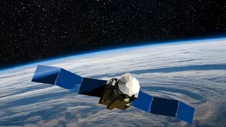







A New 'Eye in the Sky'
The Indian Space Research Organisation (ISRO) has successfully launched its EOS-05 satellite, a state-of-the-art Earth observation spacecraft. What makes this mission particularly significant is its destination: a geosynchronous orbit (GSO) nearly 36,000
kilometres above the Earth. Unlike most Earth-imaging satellites that operate in Low Earth Orbit and pass over locations only at intervals, a satellite in GSO moves at the same speed as the Earth's rotation. This allows it to remain stationary over the Indian subcontinent, providing near-continuous monitoring of a large geographical area. This capability represents a major leap forward, building on the legacy of ISRO's Indian Remote Sensing (IRS) satellite program, which began in 1988 and has since become one of the world's largest constellations of remote sensing satellites.
Game-Changer for Disaster Management
One of the most critical applications of the EOS-05 is in disaster management. Its ability to provide frequent, large-area imagery is invaluable for monitoring rapidly developing natural disasters. This includes tracking cyclones, observing the spread of floods, and detecting forest fires in near real-time. Before, there might be a delay of hours or even days to get a clear picture of an affected area from a passing satellite. With EOS-05, authorities can receive data much more quickly, enabling faster and more effective emergency response, planning, and recovery efforts. This constant watchfulness can mean the difference between timely intervention and a delayed reaction when lives and property are at stake. This mission succeeds the objectives of the failed EOS-03 launch in 2021, which was also intended to provide this agile imaging capability.
Boosting Agriculture and Protecting Resources
Beyond emergencies, India's Earth observation program has long been a pillar of support for the national economy, especially agriculture. Data from these satellites is used for a wide range of applications, from forecasting crop acreage and production to monitoring the health of forests and managing water resources. The EOS-05, with its advanced imaging capabilities across multiple spectral bands, will enhance this support. It can help create detailed maps for urban and rural planning, prospect for minerals, and monitor environmental changes with greater frequency and detail. By providing consistent data, the mission helps create better information systems for everything from watershed development to ensuring the sustainable use of the country's natural resources.
A Strategic Asset for National Security
The capabilities of the EOS-05 satellite are not limited to civilian use. The satellite also serves important strategic and security needs for the country. Its ability to maintain a constant vigil over the Indian subcontinent and adjoining regions makes it a powerful tool for border surveillance and monitoring. The near real-time imagery can provide crucial intelligence and enhance situational awareness for defence purposes. This dual-use capability is a hallmark of advanced space programs, where technology developed for scientific and developmental purposes also contributes to strengthening national security. While many details of its strategic applications remain classified, the persistent-stare capability is an undeniable asset for monitoring areas of interest.