


Finding Your Way in a Vacuum
For more than fifty years, since the Apollo missions, navigating in space has been a complex dance between spacecraft and mission control. Every move, from major orbital adjustments to a rover turning a corner, has relied on a constant stream of communication
with Earth. Giant antennas in NASA's Deep Space Network send and receive signals, allowing ground crews to calculate a spacecraft's position and trajectory with incredible precision. But this method has its limits. There's a time delay, the network is in high demand, and as we plan more ambitious missions—including a permanent base—this reliance on Earth becomes a bottleneck. For astronauts on the lunar surface, especially in the rugged, shadowy terrain of the south pole, waiting for directions from over 380,000 kilometres away isn’t just inefficient; it’s a potential safety risk.
A 'GPS' for the Moon
Enter the concept of a lunar GPS. NASA, along with international and commercial partners, is developing technology to create local navigation signals on and around the Moon. The goal is to build an architecture, dubbed LunaNet, that functions much like the internet and Global Navigation Satellite Systems (GNSS) on Earth. Instead of relying on Earth, future lunar explorers—both human and robotic—could tap into a network of lunar-orbiting satellites and surface beacons to get real-time, precise location data. A key part of this effort involves technology demonstration payloads, like the Lunar GNSS Receiver Experiment (LuGRE) and the newer NavCube3-mini, which are designed to prove that this can be done.
How It Actually Works
The first step is surprisingly clever: using what’s already there. Earth’s GPS and other GNSS constellations, like Europe's Galileo, broadcast signals primarily for our planet, but much of that signal 'spills over' into deep space. Specially designed receivers, like those on the LuGRE and NavCube3-mini payloads, are sensitive enough to pick up these faint, stray signals at lunar distances. Recent experiments have successfully demonstrated that these signals can be acquired and used to calculate a position in lunar orbit and even on the surface. This proves the concept without having to first launch a costly new satellite constellation. The long-term plan under the LunaNet framework is to create a dedicated network of lunar satellites that will provide even more robust and reliable service, creating a true interplanetary internet and navigation system.
Why Local Navigation Is a Game Changer
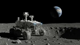
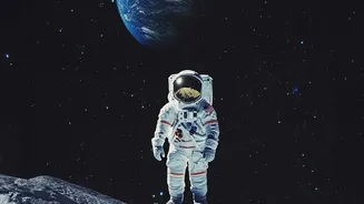
The shift from Earth-dependent to autonomous lunar navigation is revolutionary. For astronauts conducting geological surveys or rovers exploring craters, it means having a reliable map that shows their position in real-time, just like on a car’s dashboard. This dramatically increases safety, efficiency, and the potential for scientific discovery. It enables precision landing of spacecraft at scientifically interesting or resource-rich sites without direct oversight from mission control. Furthermore, it empowers autonomy. Rovers can navigate complex terrain on their own, and spacecraft can perform complex rendezvous and docking maneuvers without human intervention. This infrastructure is essential for establishing a sustainable human presence and a thriving lunar economy.
The Road Ahead for Lunar Travel
The development of lunar navigation is happening now. As part of NASA's Commercial Lunar Payload Services (CLPS) initiative, payloads are being sent to the Moon on missions from private companies like Intuitive Machines and Firefly Aerospace. The NavCube3-mini was recently delivered for integration onto the Altus-1 lunar relay satellite, which will be part of a network providing communication and navigation services. These early demonstrations are collecting vital data that will inform the build-out of the complete LunaNet system. This work is a foundational component of the Artemis program, which aims not just to return humans to the Moon, but to stay, building a base and preparing for humanity’s next giant leap to Mars.