



The First Domino: A Glacier's Collapse
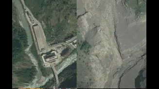
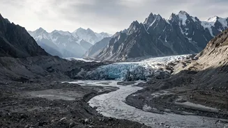
High-resolution satellite pictures captured before and after the disaster on August 26, 2026, pinpoint the likely trigger: the collapse of a large section of a glacier. Scientists analysing images from Planet Labs and other providers identified that a massive
chunk of ice and rock broke away from a glacier high in the mountains near the Nepal-China border. This was not an earthquake; seismic sensors did pick up a major event, equivalent to a 5.2 magnitude quake, but the U.S. Geological Survey concluded this signal was generated by the glacial collapse itself, not a tectonic shift. The mass of ice, estimated to be the size of 25 football fields, plunged hundreds of metres into the valley below, unleashing unimaginable kinetic energy.
A Wall of Water and Debris
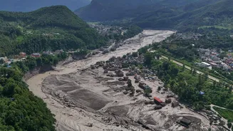
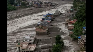
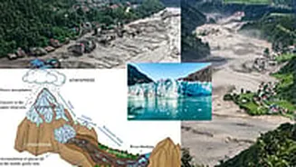
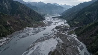
The initial collapse created a destructive avalanche of ice and rock. Scientists believe this avalanche may have then temporarily dammed the river in the narrow valley. When this natural dam gave way, it released a torrent of water downstream with enormous force. This surge, a powerful debris flow, gathered sediment, boulders, and anything else in its path as it thundered down the Bhote Koshi-Trishuli river system. Before-and-after imagery shows the dramatic transformation of the landscape: narrow, green river valleys turned into wide, brown scars of sediment and destruction. The river channel itself was visibly widened, carving out new paths and erasing what was once there.
Tracing the Path of Destruction
The satellite view provides a bird's-eye map of the devastation. Key infrastructure points, once clearly visible, have simply vanished. Images show the complete destruction of the Rasuwagadhi border post, a crucial trade and transit point between Nepal and China's Tibet region. Further downstream, hydropower plants that contributed significantly to Nepal's electricity supply were wiped out. The images track the flood's destructive path for miles, confirming on-the-ground reports of annihilated villages like Timure and Syabrubesi, washed-out bridges, and the destruction of a nearly 60-kilometre stretch of vital roadway. What were once bustling settlements and critical infrastructure corridors are now buried under a thick layer of mud and debris.
A Warming Climate's Deadly Signature
While scientists are cautious about linking any single event directly to climate change, the disaster fits a deeply worrying pattern for the Himalayas. The region is warming much faster than the global average, leading to accelerated glacial melt. As glaciers retreat, they leave behind unstable rock faces and moraine dams holding back glacial lakes, increasing the risk of both landslides and glacial lake outburst floods (GLOFs). Satellite imagery taken in the days before the collapse showed a pronounced loss of snow cover on nearby glaciers, indicating unusually warm conditions. Experts warn that as glaciers shrink and permafrost thaws, the destabilizing effect on these high mountain regions will make such catastrophic events more frequent, turning them into a tragic 'new normal'.