






An Unblinking Eye in the Sky
Most Earth observation satellites operate in Low Earth Orbit (LEO), circling the globe a few hundred kilometres up. They capture high-resolution images but can only view a specific location for a few minutes during each pass. A geosynchronous satellite is
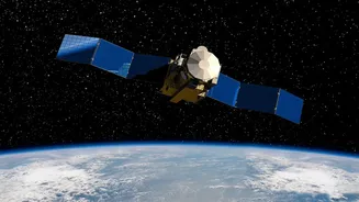
different. Positioned at an altitude of about 36,000 kilometres, its orbital period matches the Earth's rotation. This allows it to remain consistently over the same broad geographical region, offering a persistent, unblinking view. This capability transforms satellite monitoring from periodic snapshots to near-real-time surveillance, a game-changer for many applications. The EOS-05 is India's first imaging satellite designed specifically to operate from this powerful vantage point.
Redemption After a Setback
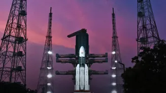
India's journey to this milestone has faced significant hurdles. The EOS-05 mission is essentially the second attempt to establish this capability. Its predecessor, GISAT-1 (also known as EOS-03), was lost during a launch in August 2021. The Geosynchronous Satellite Launch Vehicle (GSLV) carrying it suffered a technical anomaly in its cryogenic upper stage, which failed to ignite, preventing the satellite from reaching orbit. The loss was a major setback for the Indian Space Research Organisation (ISRO), which had spent years developing the complex technology. The successful launch of EOS-05 on September 4, 2026, aboard the GSLV-F17 rocket, marked a moment of redemption for ISRO, demonstrating its resilience and mastery over complex launch systems.
What EOS-05 Can Do
Weighing over 2,300 kg, EOS-05 is a state-of-the-art satellite packed with advanced imaging instruments. It is equipped with multi-spectral and hyperspectral imagers that can capture data across various wavelengths of light, revealing details invisible to the human eye. According to ISRO, it can image the entire Indian landmass roughly every 30 minutes and can focus on specific areas of interest for a new image every five minutes. This allows for rapid monitoring of fast-developing events. With a planned operational life of at least seven years, the satellite provides a long-term strategic asset. Its capabilities place India in an elite group of nations, including China and the US, that operate high-resolution surveillance satellites from such a high orbit.
A Game-Changer for National Security
The strategic implications of geosynchronous imaging are immense. For national security, the ability to continuously monitor borders and surrounding regions is invaluable. A satellite like EOS-05 can provide security agencies with near-real-time intelligence on troop movements, infrastructure development, and other activities across sensitive areas, reducing reliance on intelligence from other nations. This persistent oversight offers a significant advantage in a complex geopolitical landscape, enhancing India's strategic preparedness and situational awareness without the limitations of periodic satellite flyovers.
Beyond Defence: A Tool for the Nation
While its strategic role is critical, the applications of EOS-05 extend far beyond defence. The satellite is a powerful tool for civilian and developmental purposes. Its ability to provide frequent, wide-area imagery will revolutionise disaster management, enabling authorities to track the formation and progress of cyclones, monitor large-scale floods, and detect forest fires in near real-time. This supports quicker emergency response and better resource allocation. Furthermore, it will be instrumental for agriculture by monitoring crop health, assessing soil moisture, and managing water resources. From urban planning to environmental monitoring, the data from EOS-05 will aid in a wide spectrum of national development initiatives.