





A Thunderstorm Born from Fire
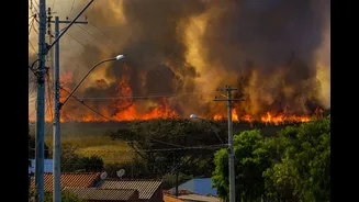
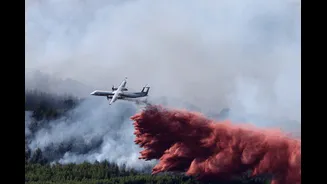
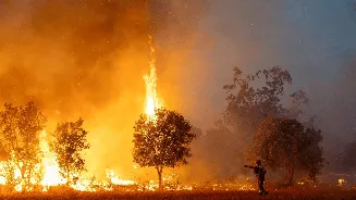
Recent images from southwestern France looked like something from a disaster film: a massive, churning pillar of smoke from a raging wildfire that billowed upwards and transformed into a sprawling, anvil-shaped thunderstorm cloud. This wasn't just smoke;
it was a pyrocumulonimbus cloud, or 'pyroCb' for short. Essentially, the wildfire became so powerful that it punched a hole through the lower atmosphere, creating its own violent weather. This phenomenon, previously considered rare in Europe, marked a first for France, signalling that its fire season has entered a dangerous new phase. The intense heat from the blaze acts like a powerful engine, sucking in air and propelling a column of hot air, smoke, ash, and moisture high into the sky.
The Science of a 'Fire Cloud'
How does a fire create a cloud? The process begins when a large, hot wildfire releases a tremendous amount of thermal energy. This heat forces a massive updraft of air, much like a hot air balloon. This column carries water vapor—released from the burning vegetation and the surrounding air—up into the colder upper atmosphere. As the plume rises, it cools, and the water vapor condenses onto the tiny particles of smoke and ash, which act as seeds for cloud droplets. This forms what scientists call a pyrocumulus, or fire cloud. If the fire is intense enough and the atmosphere is unstable, this cloud can continue to grow vertically, evolving into the much more dangerous pyrocumulonimbus—a full-blown, fire-breathing thunderstorm.
A Self-Perpetuating Monster
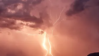
A pyrocumulonimbus cloud is far more hazardous than a normal thunderstorm. It can generate its own lightning, which can strike the dry ground miles away from the original fire, igniting new blazes and making containment efforts a nightmare for firefighters. The cloud also creates extreme and erratic winds. Violent downbursts can slam into the surface, changing the fire's direction in an instant and spreading embers far and wide. In some of the most extreme cases, these fire-generated weather systems can even spawn fire whirls, or 'fire tornadoes', with devastating rotational winds. This makes the fire's behaviour dangerously unpredictable, turning escape routes into traps and forcing firefighters into a defensive posture against an 'unstoppable' force.
A Growing Threat in India
While a pyroCb over France is alarming, the phenomenon is part of a global trend that holds critical lessons for India. Wildfires are not just a foreign problem; over a third of India's forest cover is prone to frequent fires, with climate change making fire seasons longer and more intense. States like Uttarakhand, Himachal Pradesh, Odisha, and those in the Northeast have seen a sharp rise in fire activity. As temperatures rise and droughts become more common, Indian forests are becoming more susceptible to the kind of high-intensity fires that can generate their own weather. The conditions that create 'fire weather'—high temperatures, low humidity, and strong winds—are becoming more frequent. With projections showing the fire season in India could lengthen by up to 60 days, the risk of our own forests becoming weather-makers is very real.