


Why Navigating the Moon Is So Hard
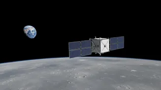
On Earth, a global network of satellites makes navigation a simple matter of checking your phone. The Moon offers no such luxury. There is no existing GPS network, no atmosphere to aid with braking manoeuvres, and communication with Earth can be delayed
or blocked by the Moon itself. For decades, spacecraft have relied on constant communication with ground stations, which use powerful antennas to track the vehicle's position and send commands. This method is reliable but slow and requires a direct line of sight. For the ambitious goals of the Artemis program, which aims to establish a sustained human presence, a more autonomous and precise system is needed, especially for landing and operating in the challenging terrain of the lunar south pole.
A GPS for the Moon
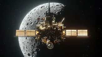
NASA's solution is a series of compact, clever payloads that effectively create a lunar GPS. One key technology is the Lunar GNSS Receiver Experiment, or LuGRE. Developed in partnership with the Italian Space Agency, LuGRE is designed to do something remarkable: catch the faint, spillover signals from Earth's own Global Navigation Satellite Systems (GNSS), which include the U.S. GPS and Europe's Galileo constellations. These signals weren't designed to reach the Moon, but with highly sensitive receivers, they can be used to calculate a precise position, velocity, and time, completely independent of Earth-based tracking. Other related technologies include laser-based systems like the Navigation Doppler Lidar (NDL), which precisely measures velocity and altitude during the critical landing phase.
How It Works: Catching Signals in Deep Space
The technology works by using a high-gain antenna and an ultra-sensitive receiver to detect the weak signals that radiate past Earth from GNSS satellites. While these signals are powerful near Earth, they become incredibly faint at lunar distances. Payloads like the NavCube3-mini, which is about half the size of a shoebox and weighs just 3.5 pounds, are engineered specifically for this weak-signal environment. This allows a spacecraft, rover, or even a future astronaut to determine their location autonomously, in real-time. Early demonstrations of this technology have been successful, with missions acquiring navigation fixes from hundreds of thousands of kilometers away, proving the concept is viable for sustained lunar operations.
Unlocking Hard-to-Reach Lunar Terrain
This new navigational capability is a game-changer for the Artemis program. Many of the most scientifically interesting and resource-rich locations on the Moon are also the most dangerous to get to. The lunar south pole, for example, is believed to hold vast quantities of water ice within its permanently shadowed craters. This ice is a critical resource for future bases, providing water, air, and rocket propellant. However, the region is marked by extreme temperatures, long shadows that obscure hazards, and rugged terrain. Precise, autonomous navigation is essential for landing safely in these areas, exploring craters, and establishing the infrastructure for a permanent lunar base. By providing a reliable positioning system, these payloads pave the way for missions to explore these previously inaccessible frontiers.