





The Moon’s Navigation Problem
On Earth, we take GPS for granted. But on the Moon, there are no satellites to ping for a precise location. For decades, lunar missions have relied on complex and time-consuming tracking from Earth-based assets like the Deep Space Network. This system
is effective but has limitations; the network is already oversubscribed, and it prevents spacecraft from navigating fully on their own. This dependency on Earth is a major bottleneck, especially as lunar traffic increases and missions target areas without a direct line of sight to our home planet, such as the far side or deep craters at the poles.
Enter Lunar Node 1: A 'Lighthouse' for the Moon
To solve this, NASA has been developing and testing new autonomous navigation systems. A key experiment is the Lunar Node 1 (LN-1), a radio beacon designed to act like a navigation lighthouse on the lunar surface. Developed at NASA's Marshall Space Flight Center, LN-1 is a compact, S-band navigation beacon that was successfully tested as part of a Commercial Lunar Payload Services (CLPS) mission. Its goal is to provide a reference signal that allows orbiters, landers, and even astronauts to determine their position relative to it, without constantly checking in with Earth. The successful demonstration showed that the technology can support local surface and orbital operations, a critical step toward greater autonomy.
Building a Network in the Sky
LN-1 is just one piece of a larger puzzle. The ultimate vision is a network of interconnected systems called LunaNet, which would function like an internet and GPS for the Moon. This includes not only surface beacons but also orbital assets. NASA recently delivered another key piece of hardware, the NavCube3-mini, a powerful and compact receiver designed to use signals from existing Earth-based GPS and Galileo satellites at lunar distances. Weighing just 3.5 pounds and using the power of a standard laptop, this technology allows spacecraft to determine their position autonomously. These payloads are being tested on missions from commercial partners like Intuitive Machines and Firefly Aerospace, proving that a lunar navigation network is feasible.
Why the Lunar South Pole is the Ultimate Test
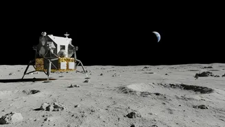
The primary target for these new technologies is the Moon's South Pole. This region is scientifically vital because it contains permanently shadowed craters that are believed to hold vast quantities of water ice—a crucial resource for future long-term habitats. However, it is also incredibly difficult to traverse. Unlike the relatively flat plains of the Apollo landing sites, the South Pole features deep craters and high mountains that can block communications with Earth. Safe and precise navigation is essential for both robotic and human missions to land, explore, and establish a base in this challenging but rewarding environment. An autonomous navigation system would allow rovers and astronauts to explore these shadowed regions while maintaining situational awareness.
What This Means for the Artemis Generation
The successful tests of payloads like LN-1 and NavCube3-mini are foundational to the ambitions of NASA's Artemis program, which aims to establish a sustained human presence on the Moon. By creating a reliable and autonomous navigation infrastructure, NASA and its partners are making lunar exploration safer, more efficient, and more scalable. This technology will enable precise landings, support complex surface operations, and even provide a framework for a lunar search and rescue system, known as LunaSAR. Ultimately, these navigation aids are not just about getting from point A to point B; they are about building the scaffolding for a permanent human foothold on the Moon and preparing for the next giant leap to Mars.