








A New, Alarming Record
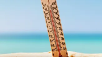
In late August 2026, the global average sea surface temperature reached a new peak of 21.1°C, surpassing the previous record set just months earlier in March 2024. What makes this new milestone particularly concerning for scientists at Copernicus is its
timing. Typically, oceans are warmest in March after the Southern Hemisphere's summer. Setting a new record in August signals an unusual and powerful accumulation of heat in the climate system. This is not an isolated event but part of a consistent trend that has seen monthly sea surface temperature records fall throughout 2026. The world's oceans have absorbed over 90% of the excess heat from human activities, and the rate of this warming has nearly doubled in the last two decades alone.
The Natural Amplifier: El Niño
One of the key drivers identified is a strengthening El Niño event. El Niño is the warm phase of the El Niño-Southern Oscillation (ENSO), a natural climate pattern in the tropical Pacific that occurs every two to seven years. It involves the unusual warming of surface waters in the central and eastern Pacific Ocean, which disrupts wind and rainfall patterns globally. While El Niño is a natural cycle, it temporarily raises the global average temperature by releasing vast amounts of heat from the ocean into the atmosphere. The current El Niño is forecast to be particularly strong, potentially reaching levels not seen in decades, which amplifies its warming effect on the already hot oceans.
The Underlying Problem: Long-Term Heating
El Niño, however, is only part of the story. Scientists are clear that this natural event is now occurring on top of a dangerously elevated baseline temperature caused by decades of human-driven climate change. The accumulation of greenhouse gases in the atmosphere has led to a steady, long-term increase in ocean temperatures. Over the last four decades, the average sea surface temperature has risen by about 0.6°C. Think of long-term warming as raising the entire floor, while El Niño is a temporary jump on that already higher floor. This combination is what pushes temperatures into record-breaking territory. The phenomenon is a clear example of how natural variability and anthropogenic warming can interact to produce unprecedented climate extremes.
What This Means for India
Warmer oceans have direct and significant consequences for India. The Indian Ocean, a primary source of moisture for the monsoon, is warming faster than any other tropical ocean basin. This can have a complex and often disruptive effect on rainfall patterns. While a warmer ocean can hold more moisture, leading to heavier downpours in some instances, studies also show it can weaken the overall summer monsoon circulation over land, potentially leading to longer dry spells. Furthermore, warmer sea surfaces fuel stronger and more frequent cyclones in the Arabian Sea, increasing the risk to coastal states like Gujarat, Maharashtra, and Kerala. These short, intense periods of extreme ocean heating, known as marine heatwaves, are also becoming more common, threatening vital coral reef ecosystems in the Lakshadweep and Andaman and Nicobar Islands and impacting the fisheries that millions depend on.